Oyster Project
Aquaculture is a significant coastal industry in Tasmania, which requires advanced decision supporting tools to ensure sustainability and growth under versatile climate (rising temperature, variable rainfall, increased severe events), social (changing demographics, other industries) and environmental (harmful algal blooms, nutrient and pollutant run-off) uncertainty.
Current environmental monitoring for, and by the aquaculture sector is uncoordinated and reporting is often retrospective; so of little value for some decision making by farm managers and regulators. Real-time sensing and networking of multiple sensor systems, integration into existing and new biogeochemical models, and correlating with key environmental, biological and production events will enable greater predictive and decision making capability by all stakeholders.
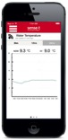
Fig. 1. Oyster farming mobile app.
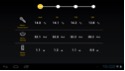
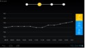
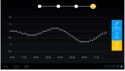
Fig. 2. Oyster farming AR app.
Dairy Farm Project
The Australian dairy Industry is a key rural industry and represents the third largest agricultural sector, with a farm gate value of $4 billion and directly employing over 43,000 Australians. Increasing intensification of both the farm and the farming business has necessitated a greater need for managing information flows on-farm. As the majority of Australian dairy farms are predominantly pasture based, the integration and presentation of key biophysical, pasture and herd data into user mobile device will rapidly assist in enhancing the effectiveness and efficiency of on-farm management. As farms become more intensive and cooperate in the operation the ability to integrate and present historical, current and forecast data relating to the key performance indicators of the business is viewed as an important operational need.
By using sensor technology from the “Sense-t” network, this Dairy Farm App will assist dairy farm managers in making informed management decision regarding their pasture and feeding in an effective and efficient manner. This will lead to increase production and utilization of the feed base. In temperate regions of Australasia, feed base management is the key determinant of the economic viability of dairy enterprises.
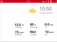
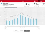
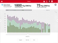
Fig. 3. Dairy farming mobile app.
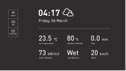
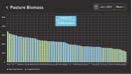
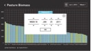
Fig. 4. Dairy farming AR app.
Viticulture Project
Situational awareness mobile app(Alpha Trial)
The Alpha Trial is the first full-scale trial of how all of the pieces of Sense-T fit together to deliver benefits for farmers. It will provide access to real-time data to help users make faster, more accurate business decisions.
The Alpha Trial will take place at 20 sites across Tasmania, incorporating a range of agricultural business including vineyards, broad acre pasture, dairy, annuals, biannual, berries, floriculture and organics.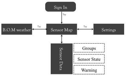
Fig. 5. Situational awareness diagram.
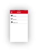
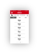
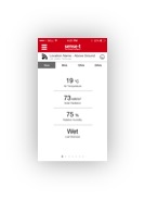
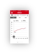
Fig. 6. Viticulture mobile app.
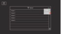
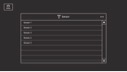
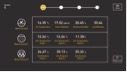
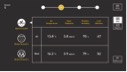
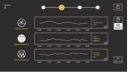
Fig. 7. Viticulture AR app.
Smart Greenhouse Project
The greenhouse is a building or complex in which plants are grown. It allows for greater control over the growing environment of plants. Depending upon the technical specification of a greenhouse, key factors that may be controlled include temperature, levels of light and shade, irrigation, fertilizer application, and atmospheric humidity.
Intelligent systems in agriculture have become more and more increasingly important over the recent years. Lighting, temperature and energy management, control and regulation make greenhouse more efficient. This project is going to build an intelligent management system, which allows the user to remote control and monitor the greenhouse, even when the user is not in the greenhouse. The system should provide flexible functionality so that it may be expanded by adding other features.
The management system is shown below in Figure 8: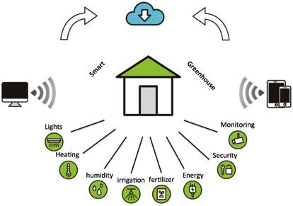
Fig. 8. Smart greenhouse concept.
AR Indoor Positioning System
HITLab AU will develop an AR location based system for farm managers. With such a system, farm managers will be able to access their farm information based upon GPS but also know how consumers consume their product using an indoor positioning system (such as iBeacon). Two front-end systems will be built for consumers and farm managers. A storyboard sketch is shown on the figure below.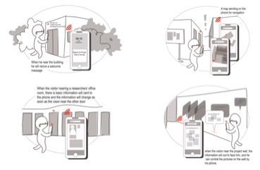
Fig. 9. Mobile client concept design.
The proposed prototype system consists of a number of iBeacon base stations, a mobile application and a respective cloud-based server. Shown in Fig. 2 is an overview of the proposed system.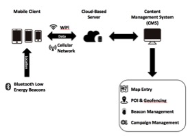
Fig. 10. System framework.
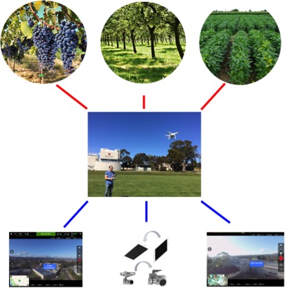
DroneAR: Augmented Reality Supported Unmanned Aerial Vehicle (UAV) in Agriculture for Farmer Perspective
DroneAR, which is use for farmer perspective in agriculture by using unmanned aerial vehicle (UAV). Although there has been a lot of types about the use of UAVs within the agricultural sector including spraying, seeding, remote sensing, precision agriculture, frost mitigation and variable rate dispersal, AR technology will reduce farmer inputs and increase their yields. Our goal is to increase farm efficiency.
The proposed application is designed to instantly provide an eye-in-the-sky image of any type of crops and any size farms and monitor farm infrastructures, livestock feedlots and pastures. The high definition video camera transmits live streaming back to the base screen. A flight plan can be set either to scan an entire farm or to follow specific waypoints. The drone will auto land when low battery power is detected, and with a home function can be returned at any time. By using the Google map API, the points of interests with the latitude and longitude coordinates are gained. DroneAR then creates labels which are scaled so that the closer POIs have larger fonts and display them on the live streaming video from UAV.