Sea levels are rising. It’s one of the biggest climate change problems facing humanity. The questions of how much and how fast have engrossed scientists across the globe. They’ve determined that sea levels are rising by about 3mm per year since 1993, but there is uncertainty about how that might change over the coming century.
We know that melting of the Antarctic ice sheet is one of the biggest drivers, but we don’t fully understand the processes that are driving the melting. It is the biggest unknown in sea level rise... and the answers lie beneath the ice.
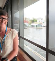
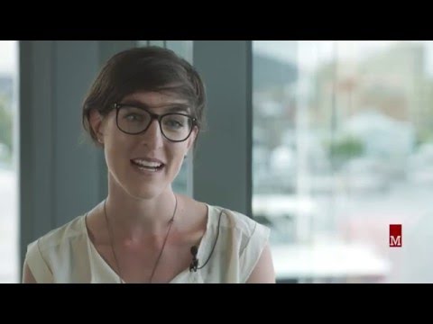
Dr Felicity Graham is an Ice Sheet Modeller, working at the University of Tasmania’s Institute for Marine and Antarctic Studies (IMAS). She is trying to understand the processes at the base of the ice sheet where the ice meets the bedrock.
I’m looking at how the ice-bedrock interaction drives the production of melt water. I’m exploring how melting is impacted by how hot the bedrock is below the ice, the elevation of the bedrock, and how rough or smooth it is.
“If the bedrock is warmer than the ice, it creates meltwater at the base of the ice sheet. Meltwater at the base of the ice sheet helps to drive ice flow, which is movement of the ice sheet on top of the continent towards the ocean.”
When ice comes into contact with the ocean, it melts, because the ocean is warmer than the ice. So ice flow is vital to understand.
Recent studies have indicated the flow of ice is speeding up in some Antarctic glaciers.
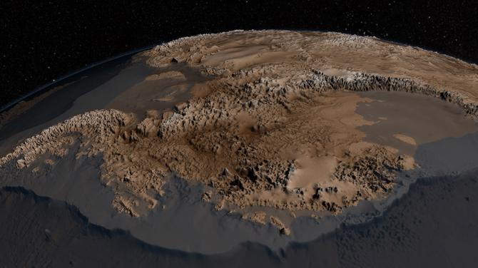
This graphic shows the elevation of the Antarctic bedrock. Image courtesy of NASA.
Buttressing is a process where ice build up at the coast slows the flow into the ocean, but in recent years we’ve seen icebergs breaking off into the ocean, which then allows glaciers to speed up.
Determining the heat flow to the ice from the underlying bedrock is one of the biggest challenges in understanding melting, according to Dr Graham.
“It is a huge issue that hasn’t been solved yet."
The slope of the bedrock is also really important in telling us how fast the ice is moving and also the likelihood that the glacier will undergo rapid retreat as the climate warms.
Glaciers that are sitting on bedrock that slopes downwards away from the ocean are at risk of retreating really quickly as the climate warms. It’s really important that we understand what the bedrock topography looks like – including how smooth or rough it is – in order to better understand how ice flow might change in the future.
How do we determine what is happening under the ice?
The Antarctic bedrock is under ice up to four kilometres thick. Observations are sparse and unevenly sampled across the continent, because there are limited windows of opportunity to collect it, and it is a time consuming job.
Data is collected from aircraft with radar equipment attached. Radar data determines bed elevation, meltwater, and ice thickness above that bed. Satellite data is used to determine the surface elevation of the ice and how fast the ice is flowing.
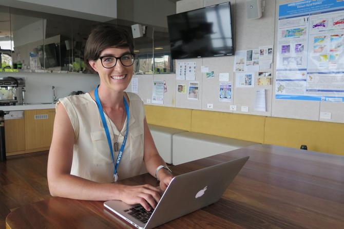
Dr Graham’s work is mostly computer-based. She uses the data collected to run numerical models of the Antarctic ice sheet.
It is maths and physics come to life. My model describes what is happening with the ice, how it flows, what is happening at the base between the ice and the bedrock.
“One question that I am asking is how important is the bedrock resolution. Do we need to know what the bedrock looks like on a 10 kilometre grid or do we need the detail of a 100 metre grid, to accurately determine what is happening?
“If I can determine how important that resolution is, it will help other researchers to understand their models better too when performing simulations on Antarctica. It’ll also help guide decision making about where we need to be collecting more data.”
Dr Graham works closely with other scientists in Tasmania and overseas. She is employed by the ARC Antarctic Gateway Partnership, which is an Australian Government funded program that draws on expertise from the University of Tasmania through IMAS, the Australian Antarctic Division, the CSIRO, and international partners.
She is currently collaborating with scientists in the US, including at the Jet Propulsion Laboratory at NASA, and in Europe.
The work that Dr Graham is doing forms one piece of an incredibly important puzzle. Her data will be shared across the globe.
"I collaborate with experts from around the world to better understand what my model is telling us. A lot of these people are highly skilled in computer modelling. They all provide data and expertise that help drive my project forward."
What is the ultimate goal of the research?
“The ultimate goal of my research is to be able to give humanity a better estimate of sea level rise over the coming century with smaller error bounds.
Science can help by accurately informing communities, councils, and governments on the future before them so they can create policy and plans to adapt. I also hope that what I do will allow us to communicate better with the community about climate change impacts.
If we can give people more concrete information, like what is going to happen to Ralph’s Bay or the Hobart waterfront, they may be more inclined to act.
This research is supported by an Australian Research Council grant.
Interested in conducting your own research? Apply now to become a research student.