
Telling Places in Country (TPIC)
October 31 1830 - TPIC
Commentary by Patsy Cameron.
Reference: (FM) Plomley, N.J.B. (ed.) Friendly Mission: the Tasmanian journals and papers of George Augustus Robinson (1966)
Daily Project Commentaries
31 October 1830
It was the last day of October when Robinson's group broke camp at 7am and set out to make their return trip to basecamp. Their route followed a ridge along the eastern edge of Mt Pearson covered with casuarina bush
![]() to the coast stopping at Sloop Rock where the women dived for crayfish for their evening meal. We noted that the stands of casuarinas bush -sheoaks and heoaks -are still evident today between Tuckers Inlet and Grants Lagoon.
to the coast stopping at Sloop Rock where the women dived for crayfish for their evening meal. We noted that the stands of casuarinas bush -sheoaks and heoaks -are still evident today between Tuckers Inlet and Grants Lagoon.
Our 2007 plans to retrace the 1830 journeyline was planned to cater for two groups of walkers. Group One, made up of five members of our research team -Elder Gloria Andrews, bushwalkers Ian and Kim Matthews, Carol Williams and cameraman Simon Werne left the coast near Sloop Rock about 7 am and followed the eastern ridge towards Seatons Tier. Robinson mentioned that his group had already travelled about fifteen miles when they reached the tier from where they 'decried a smoke inland ... due west... [and] fresh made'. On reaching the apex of Seatons Tier Group One made contact by UHF radio and released an orange smoke signal to symbolise the 1830 sighting of smoke from Ansons Plain. Project manager and chief researcher (Linn Miller and Patsy Cameron) returned the signal from the Reception Camp site
![]() located between the Last River and Fight Creek on Ansons Plain. Group One continued their long trek due west towards Luethcracenner (Doctors Peak) following the red tapes that had been laid in advance to mark the route. The day was hot and the track led through rough country that had been recently burnt by wildfire.
located between the Last River and Fight Creek on Ansons Plain. Group One continued their long trek due west towards Luethcracenner (Doctors Peak) following the red tapes that had been laid in advance to mark the route. The day was hot and the track led through rough country that had been recently burnt by wildfire.
![]()
When Robinson wrote about seeing the smoke he guessed that they group had about fifteen miles to walk from the tier through 'bad country' across gullies and hills before reaching the clanspeople who were burning off the landscape. It took Group One four hours to walk from Seatons Tier to reach the ridge to Luethcracenner. Group Two left the Fire Trail that runs between The Gardens and Ansons Bay Road about 1pm and met the five Group One walkers midway up Luethcracenner's ridge about three pm.
![]() Shortly after this significant joining together of our two groups a large white sailing ship came into view through the giant gumtrees as it passed slowly by Sloop Rock.
Shortly after this significant joining together of our two groups a large white sailing ship came into view through the giant gumtrees as it passed slowly by Sloop Rock.
![]() Some of the group saw this image as a ghostly vision from the past and it was from this moment that many felt as if they had walked into a vortex and gone back into time. Was this Robinson's supply boat? It was eerie from this time for some of us who felt that we were indeed walking with our ancestors towards the apex of Luethcracenner (319 metres high).
Some of the group saw this image as a ghostly vision from the past and it was from this moment that many felt as if they had walked into a vortex and gone back into time. Was this Robinson's supply boat? It was eerie from this time for some of us who felt that we were indeed walking with our ancestors towards the apex of Luethcracenner (319 metres high).
From a point about one hundred metres below Luethcracenner's apex we watched as Mt William came into view in the distance.
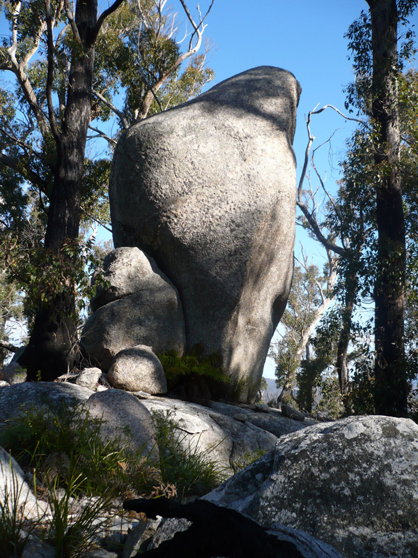
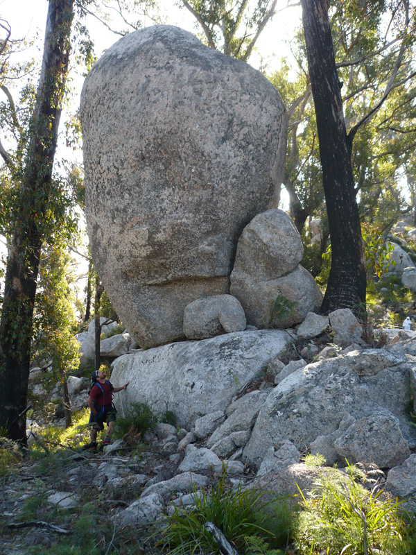
![]() We could also see clearly the grasslands around Bark Hut Marsh on the plains below. The sighting of Mt William was an extremely exciting and emotionally defining moment as it confirmed that this was the point from which Robinson took his bearings on 31 October 1830. The Elders let the ancestors know that we were approaching by clapping stones together and the sounds of kookaburras were heard laughing at us from the high canopy of gum trees. The high granite boulders stood up all around like giant sentinels watching as we walked by.
We could also see clearly the grasslands around Bark Hut Marsh on the plains below. The sighting of Mt William was an extremely exciting and emotionally defining moment as it confirmed that this was the point from which Robinson took his bearings on 31 October 1830. The Elders let the ancestors know that we were approaching by clapping stones together and the sounds of kookaburras were heard laughing at us from the high canopy of gum trees. The high granite boulders stood up all around like giant sentinels watching as we walked by.
![]() On reaching the apex we were overwhelmed by the days achievements. Two Elders, Bernice Condie and Gloria Andrews raised the flag and claimed Luethcracenner
On reaching the apex we were overwhelmed by the days achievements. Two Elders, Bernice Condie and Gloria Andrews raised the flag and claimed Luethcracenner
![]() as Aboriginal land and gave the peaked hill its correct name. The men tied the flag onto a high tree trunk and anchored it into the ground as a symbol of the historic event and to celebrate the importance of our successful walk to the top of Luethcracenner.
as Aboriginal land and gave the peaked hill its correct name. The men tied the flag onto a high tree trunk and anchored it into the ground as a symbol of the historic event and to celebrate the importance of our successful walk to the top of Luethcracenner.
![]() The Aboriginal women ground ochre and every member of our team were spiritually cleansed with ochre on their faces, hands and arms.
The Aboriginal women ground ochre and every member of our team were spiritually cleansed with ochre on their faces, hands and arms.
![]() Sammy Howard released an orange smoke flare from a rocky outcrop directly above the Reception Camp on the plain below.
Sammy Howard released an orange smoke flare from a rocky outcrop directly above the Reception Camp on the plain below.
![]() We did not want to leave. After a short time we began our descent and retraced our footsteps down the ridge to the Fire Road and on to the Reception Camp by vehicle.
We did not want to leave. After a short time we began our descent and retraced our footsteps down the ridge to the Fire Road and on to the Reception Camp by vehicle.
When mapping the route to the 'peaked hill' that Robinson had referred to the editor of Friendly Mission , NJB Plomley, noted that
'This peak has tentatively been identified as an unnamed hill (c 1000feet) due west of Mt Pearson, on the eastern edge of Goulds Country. It is considered that an accurate plot of the route of Robinson's return trip to his base camp at Great Mussel Roe River must wait upon a trip through the region. It must be emphasised that in plotting Robinson's journeys the method adopted of working from maps is not really satisfactory and should have the support of study of the country itself. For regions where accurately contoured maps are available the routes shown are probably fairly accurate, but in other parts- and this in one of them- there is doubt as to the accuracy of the plotting' (Plomley, 1966: 438 note 38).
Therefore, an accurate location and identification of this peak was critical to this research project as it held the key to the meeting place of Mannalargenna and Robinson on 1 November 1830. Robinson noted from this peaked hill the smoke from the burning scrub were seen on the plain below and the meeting was within 'two miles' of the fires ( Plomley, 1966:438 note 39). Robinson's party arrived on Anson's Plain as night fell after completing the long walk he estimated to be over 20 miles through the bush, hills and gullies. As it had been raining most of the day the marshlands through which the Last River and Fight Creek flowed would have been wet and boggy. It is reasonable to expect that they would have made their camp on a dry bank between the two waterways below Luethcracenner. While Robinson and the male guides went in search of any sign of the clan and to dry themselves beside the burning trees the women roasted the crayfish to eat before resting for the night. Robinson wrote in his journal that night that he was convinced that the clanspeople they were searching for had probably gone to shelter from the rain in a bark hut. He would have to wait until morning to make contact with the fire makers.
Our 2007 team gathered at our Reception Camp
below Luethcracenner and celebrated our successful journey from Sloop Rock to Ansons Plain. On our arrival at the campsite in the late afternoon we were greeted with great emotion by Ronnie and Dyan Summers and Dawn Maher who had not been able to do the walk today. They presented each of us with beautiful little floral bouquets of wild flowers and hot drinks.
![]() Ronnie.
Ronnie.
![]() sang his famous rendition of Mannalargenna and we shared our experiences as a group as the sun's final rays settled on Luethcracenner. Some of us searched for and glimpsed the flag among the trees as it moved in the wind high above the plain.
sang his famous rendition of Mannalargenna and we shared our experiences as a group as the sun's final rays settled on Luethcracenner. Some of us searched for and glimpsed the flag among the trees as it moved in the wind high above the plain.