
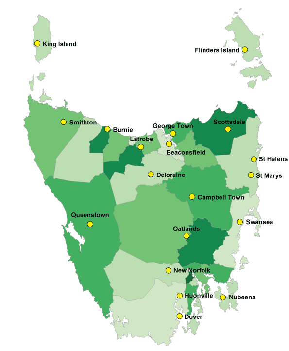
Rural Health Teaching Site Locations
There are 19 Rural Health Teaching Sites across Tasmania. For further information select a site from the above menu.
In addition, the Rural Clinical School has accommodation at Burnie and Latrobe which may be available to students undertaking placements in these areas. Further information
The accommodation is offered on a share-basis and is within walking distance of local health services. It is fully self-contained with cooking and laundry facilities. The type of IT services varies from site to site. Students should check with their mobile phone service provider to ensure they have coverage. Site-specific information will be provided when bookings are confirmed.
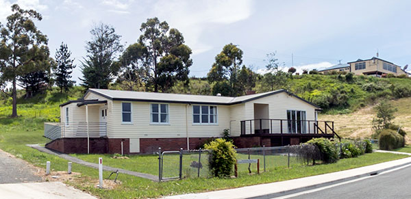
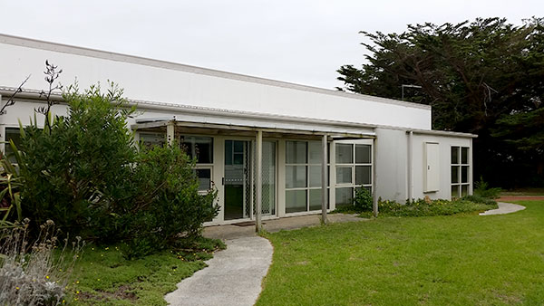
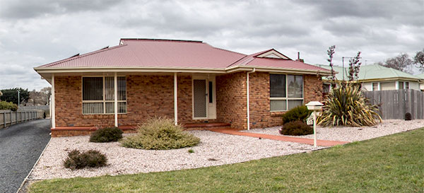
Accommodation at Beaconsfield is located on-site at the Beaconsfield District Health Service. It provides comfortable hostel-type accommodation. WIFI is provided.
About Beaconsfield
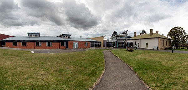
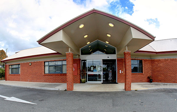
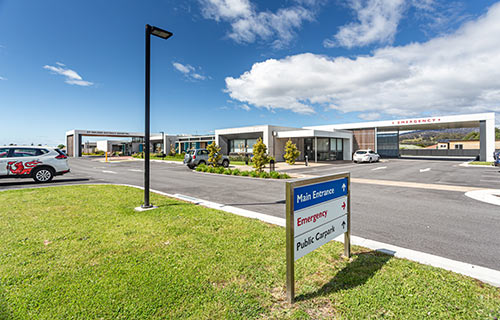
Beaconsfield District Health Service
Beaconsfield is a former gold-mining town located approximately 40kms north of Launceston on the West Tamar Highway. First explored by Europeans in 1804, it is one of Australia’s oldest settlements, originally known as Brandy Creek. Gold was discovered in 1869 and mining commenced in 1877. In 1879 it was renamed Beaconsfield in honour of British Prime Minister Benjamin Disraeli, 1st Earl of Beaconsfield. In 1953, Beaconsfield became the first town in Australia to fluoridate its water supply, and became famous globally after the 2006 mine collapse.
Beaconsfield is located in the Tamar Valley Wine Region and is close to a number of vineyards and orchards (apples and cherries).
Resources
Health Services
- Beaconsfield District Health Service
- West Tamar Pharmacy, 144 Weld Street, Beaconsfield
- Beaconsfield Doctors Surgery, 144 Weld Street, Beaconsfield
- Beaconsfield Medical Service, 146 Weld Street, Beaconsfield
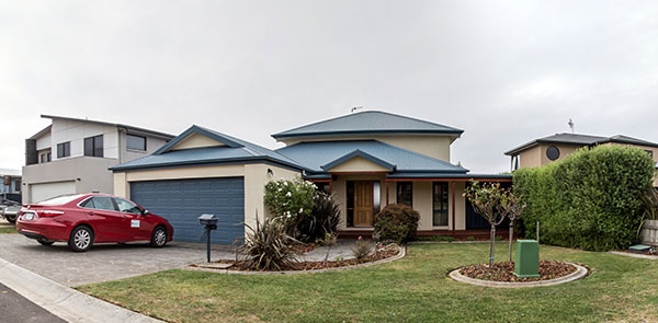
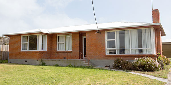
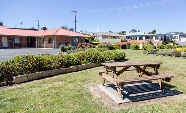
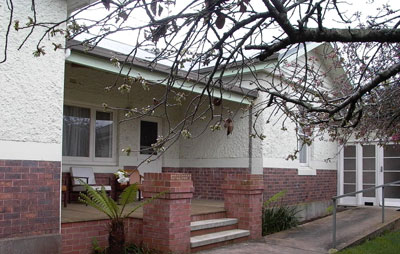
The accommodation at Burnie consists of three modern rental properties in pleasant residential surroundings. Two of the houses have four bedrooms, with the third having three. All have two bathrooms and offer students a high standard of comfort and amenity. NBN WIFI is provided.
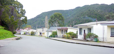
About Burnie
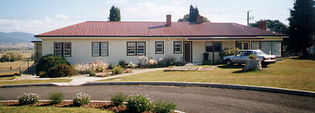
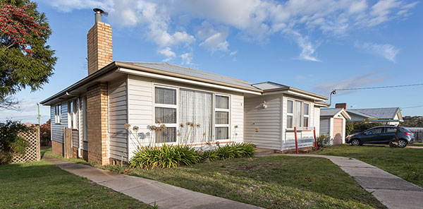
Burnie teaching site
Burnie is Tasmania’s most westerly city, located on the North West Coast about 40 minutes from Devonport. It has a northerly aspect and is nestled around Emu Bay on Bass Strait.
Burnie has about 20,000 residents, a cool temperate climate with impressive gardens and parks. The city is surrounded by beautiful beaches, sparkling water and fresh air. Together with a dynamic cultural life, galleries, performances, exhibitions and community events.
Burnie also hosts a busy container port, a rail hub and factory framework lining the highway around Emu Bay.
Resources
- Burnie City Council
- Visitor Information Centre (Discover Burnie)
Health Services
Campbell Town Health & Community Service
The Northern Midlands Rural Health Teaching Site is approximately 500 metres from the Campbell Town Health and Community Service. It consists of a four-bedroom house and a learning centre located at the health service. WIFI is provided.
Close to local cafes and bakeries, finding something to eat at the end of a long day is never a problem!
About Campbell Town
Campbell Town has a rich and interesting history. It was established as one of four garrison towns between Hobart and Launceston and has thirty-five buildings listed on the National Estate. The three arch Red Bridge at the southern end of the town was built by convicts between 1836 and 1838 while The Fox Hunters Return (1840), a two-storey rubble stone building, is considered to be one of the most substantial hotel buildings of the period. Close to the RHTS in King Street is St Michael's Church (1857) with the initials of the Bishop of Tasmania, Bishop Wilson, engraved into the south east wall.
The Campbell Town Railway Station is reputedly the site of Australia's first telephone conversation which was recorded by Alfred Biggs. The telephone is made of Huon Pine and is now on display at the Heritage Highway Museum. Campbell Town is also the birthplace of Harold Gatty, who was navigator during the American pilot Wylie Post's round-the-world aeroplane flight in 1931. Gatty also designed the navigational system used by the US Airforce during the Second World War.
Campbell Town has a world-class reputation as a major sheep farming centre. Saxon Merino sheep were introduced into the area in about 1823 and by the 1830s, had established Campbell Town as the centre of the Van Diemen's Land fine wool industry. The first sheep show was held in 1839 and the Campbell Town Show is the longest running agricultural show in the British Commonwealth.
Resources
Health Services
- Campbell Town Health and Community Service
- Campbell Town Health and Community Service Virtual Tour
- Campbell Town Pharmacy, 2/119 High Street, Campbell Town
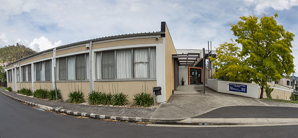
Deloraine District Hospital and Community Health Services
The Deloraine accommodation is located approximately two kilometres from the Deloraine District Hospital and Community Health Centre. The house has three bedrooms, WIFI (NBN), and there is a designated training room at the hospital.
The proximity of the house to the Western Tiers provides views over Quamby Bluff and beyond, and opportunities for bushwalking on the weekends.
About Deloraine
Deloraine is a pretty town on the banks of the Meander River which is situated in the foothills of the Great Western Tiers. The town is classified by the National Trust, and many of the buildings are from the Georgian and Victorian eras. There is an extensive dairy industry surrounding the town, and it is a major centre for arts and crafts. The annual craft fair is reportedly the largest in the southern hemisphere, attracting up to 40,000 visitors annually. Deloraine is a base for visitors wishing to explore the natural beauty of the nearby mountains, including day walks to Meander Falls, Mount Roland and Liffey Falls, just to name a few. Tasmania's first rail link was laid between Launceston and Deloraine in 1872.
Deloraine is approximately 50 km west of Launceston and 52 km from Devonport.
Resources
- Meander Valley Council
- Tourist Information (Discover Tasmania)
Health Services
- Deloraine District Hospital
- Deloraine District Hospital Virtual Tour
- Deloraine Medical Centre, located at 22 Tower Hill Street.
- Aged Care Deloraine
- Amcal Pharmacy is located at 62-64 Emu Bay Road
Dover teaching site
The Dover Rural Health Teaching Site is a short walk from the Esperance Multi-Purpose Centre and other health services.
The accommodation has two bedrooms, computer and WIFI.
Dover is located on beautiful Esperance Bay and the views from the house provide a calming and relaxing end to a long day on placement!
About Dover
Dover is a picturesque fishing village 79km south of Hobart and is set in the majestic Huon Valley. Other population centres in the region include Huonville, Geeveston, Franklin and Cygnet. Dover's main industries are fishing and aquaculture. Fishing boats leave Dover for the rough waters around South East Cape and Port Davey where they fish for abalone and crayfish, while the unpolluted waters have attracted a number of Atlantic Salmon farms to the area. The farms and the TasSal processing plant employ large numbers of local people with the majority of the produce being exported to Asian and interstate markets.
Dover is set on the edge of the South West Wilderness alongside vast forest reserves. Much of its early history was built around the timber industry and the region continues to provide timber for the paper and sawmilling industries. This region has been an area of ongoing conflict between environmental and timber industry groups over the issue of logging old growth forests.
The Huon Valley is the region that made Tasmania famous as the "Apple Isle." There are many apple orchards in the area as well as berries, cherries and other fruits.
The tiny township of Hastings is south-west of Dover and is best known for the Hastings Caves State Reserve. Unlike most caves in Australia which are formed from water action on limestone, the Hastings Caves occur in dolomite. Cockle Creek is around 15km from Hastings and is the most southerly point of Australia accessible by car. From this point there are fantastic walks to Port Davey and the mountain peaks of the South West.
Resources
- Tourist Information (Discover Tasmania)
- Huon Valley Council
Health Services
Flinders Island teaching site
The Flinders Island Rural Health Teaching Site is located in Whitemark, the commercial and administrative centre of the Island. It is a short walk to the Flinders Island Multi-Purpose Centre, shops and the Whitemark Beach.
The three-bedroom house has recently been refurbished with a new kitchen and bathroom. WIFI is provided through a Satellite NBN service.
About Flinders Island
Flinders Island has a population of approximately 850 and is the largest of the 52 islands of the Furneaux Group. It is approximately 60km in length and 20km in width.
Flinders Island was discovered by Europeans in 1773 when Tobias Furneaux, the commander of Captain Cook's support ship, became separated from the Endeavour in fog. During the 19th century it was a base for the sealing industry and today its main industries are farming, fishing and tourism. Mutton birding is carried out on a seasonal basis.
There is a small permanent population on nearby Cape Barren Island. As part of your rural clinical placement, you may be asked to accompany the local GP on his fortnightly visit.
Flinders Island has majestic mountains, unspoilt beaches, crystal clear water, and an abundance of wildlife. Make sure you take your camera with you.
Resources
- Flinders Council
- Tourist Information (Visit Flinders Island)
Health Services
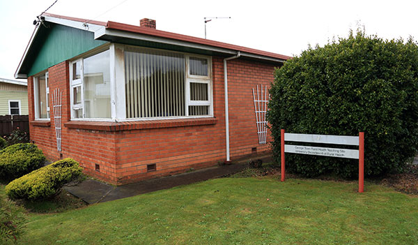
George Town teaching site
The George Town Rural Health Teaching Site is a short walk from both the George Town Hospital and Anne Street Medical Services. It has three bedrooms, a computer and printer, and WIFI (NBN).
Walking tracks at beautiful York Cove provide students with plenty of opportunities to exercise and to explore the area.
About George Town
George Town is located on the eastern side of the mouth of the Tamar River, about 45 km north of Launceston. It was settled under Lieutenant Colonel William Paterson in 1804, and was the third European settlement in Australia after Sydney and Hobart.
Launceston was established in 1806 and became the administrative centre of northern Tasmania. However, Governor Lachlan Macquarie believed George Town to be a better site and ordered the northern headquarters to be moved. Despite a lack of enthusiasm, the town plans were laid out in 1816 and the town was named after George III. Macquarie's decision was reversed by the Bigge Report of 1825 and the administration moved, once again, to Launceston.
George Town initially consisted of a military station, female factory and a few settlers. During the 1830s, it was an embarkation point for settlers leaving for the Port Phillip district and the discovery of gold nearby in the 1870s saw the population increase.
In 1948, work began on the aluminium refineries and smelter at Bell Bay and production began in 1955 under the management of the Australian Aluminium Production Commission, a joint Australian and Tasmanian Government venture. In 1961 the facility was sold to Comalco and the town grew as Comalco expanded its operations. Other developments were subsequently attracted to the town including oil terminals, a roll-on roll-off shipping terminal (1958), the Temco high carbon terro manganese plant, and two wood chip companies. Bell Bay became Launceston's container port and the site of Launceston's thermal power station (1971).
In 1991, the Bass Strait ferry service from George Town ended and a high speed catamaran services failed in 1996. The Iron Baron, an oil carrier, ran aground near George Town in 1996.
Australia's oldest continuously used pilot station is located at Low Head, north of George Town. Several buildings at Low Head are listed on the Register of the National Estate.
Resources
- George Town Council
- Tourist Information (Discover Tasmania)
Health Services
Huonville teaching site
The accommodation at Huonville consists of two modern rental properties offering students a high level of comfort and amenity. NBN WIFI is provided.
About Huonville
Huonville, with a population of around 1,700, is the main residential and business centre in the Huon Valley. Other population centres are Dover, Geeveston, Franklin and Cygnet.
The Huon Valley is a vibrant, semi-rural community 30 minutes south of Hobart. It is Australia’s southernmost municipal area with a population of more than 15,000 people.
The Valley’s 5,497 square kilometres are dominated by pristine rivers meandering through valleys bordered by World Heritage-listed national parks. The region’s fertile landscape produces an array of quality foods. It is renowned for its scenic beauty and popular fishing and boating spots.
Best known as one of Tasmania’s primary apple growing areas, the district now boasts cherry and fish farming as well as superb grass fed meat.
The Valley is also famous for the Huon pine tree, much of which has been logged for decades. The trees that remain are strictly protected.
Resources
- Huon Valley Council
- Tourist Information (Huon Valley Visitor Centre)
Health Services
King Island teaching site
The King Island Rural Health Teaching Site is located on site at the King Island District Hospital and Health Centre. There are three bedrooms, each with ensuite bathrooms.
King Island cows produce some of the best cheese in Tasmania and a visit to the cheese factory is a must for any students visiting the Island.
About King Island
King Island is situated in western Bass Strait and is approximately 58km long and 21km wide. The main township is Currie and there are two smaller towns, Grassy Harbour and the seaside village of Naracoopa.
Each year King Island plays host to large numbers of tourists each who are attracted to its spectacular coastline, unspoilt beaches and friendly people.
Resources
Hint: The King Island Dairy sells a wide range of premium cheeses at very reasonable prices.
Health Services
Latrobe teaching site
The Rural Health Teaching Site at Latrobe consists of a four-bedroom house and six self-contained units – it was originally the Latrobe Motel! Each unit has a bathroom and cooking facilities, although students may access the kitchen in the house if they wish. WiFi (NBN Fibre to the Node) is provided. The Latrobe RHTS is located across the road from the Mersey Community Hospital and is a short drive from Devonport.
Latrobe is ideally located for students wishing to climb nearby Mt Roland or visit Cradle Mountain.
About Latrobe
Latrobe is located on the Bass Highway approximately 92kms from Launceston and 8kms from Devonport. The town has a well-preserved heritage centre with many interesting buildings and features. Must visit destinations include Reliquaire, in Gilbert Street, the House of Anvers on the Bass Highway, and the Platypus Experience in Bell's Parade.
Resources
Health Services
- Mersey Community Hospital
- Strathdevon Community Residential Aged Care
- The Child Health Centre is located at 5 Hamilton Street, Latrobe
- Coventry's Pharmacy, 45 Gilbert Street, Latrobe
- Latrobe Family Medical Practice, 45B Gilbert Street, Latrobe
- Latrobe Doctors Surgery, 120 Gilbert Street, Latrobe
New Norfolk District Hospital & Community Health Centre
The accommodation at New Norfolk is a spacious three bedroom apartment located in the town centre, close to the New Norfolk District Hospital.
About New Norfolk
New Norfolk is the major regional centre in the Derwent Valley, and is located on the Lyall Highway, 32 kilometres west of Hobart. It is one of Tasmania’s oldest towns. Originally known as Elizabeth Town, many of the early settlers came from Norfolk Island, arriving between 1807 and 1808. In 1825 its name was changed to New Norfolk in honour of their former home.
New Norfolk has a wide range of historic buildings including Tasmania’s oldest Anglican church, St Matthews and one of Australia’s oldest hotels, The Bush Inn. It has a number of antique shops and provides easy access to Mt Field National Park and Lake Pedder.
The Derwent Valley is a rich agricultural region with specialty crops such as hops and cherries.
Resources
Health Services
Tasman Multi-Purpose Service
The Tasman Rural Health Teaching Site is a three bedroom house located close to both the Tasman Health and Community Service and the Tasman Pharmacy.
About Nubeena
Nubeena is located 113km south east of Hobart and 12 km from the historic penal settlement of Port Arthur. It is the administrative centre for the Tasman Municipality and the largest township on the Peninsula.
Nubeena was established as an outstation of Port Arthur and for many years was an important convict farming community. Coal was once mined in the north-west of the peninsula and the ruins of the soldiers' barracks and convict quarters can be found at nearby Saltwater River.
Nubeena is a favourite destination for surfers who are attracted to the consistently good and challenging waves at Roaring Beach and White Beach. Roaring Beach is alongside a coastal reserve with magnificent views over Storm Bay.
Resources
Health Services
- Tasman Health and Community Service Virtual Tour
- Tasman Pharmacy, 1622 Main Road, Nubeena
Oatlands teaching site
Accommodation at Oatlands consists of two three-bedroom houses, both just a short walk from local health services. WIFI (NBN) is provided at both properties.
About Oatlands
The historic town of Oatlands, with a population of approximately 500 people, is located on the shore of Lake Dulverton, an hour away from Hobart and an hour and a half from Launceston. It is the largest town in the Southern Midlands area and is surrounded by rich agricultural land.
Oatlands is one of Tasmania's oldest settlements and was named by Governor Macquarie after an English town in the county of Surrey in 1821. It was developed as a military base for the control and management of convicts because of its distance from Hobart and Launceston. Convicts were assigned to nearby farms and properties, and also worked on public buildings, roads and bridges. Oatlands is considered to have among the largest number of colonial sandstone buildings in any town in Australia, and many of them were built by convict labour.
Much of the Black War took place in the surrounding districts, and Oatlands was also the home of the ex-convict Solomon Blay, Tasmania's most feared hangman. Hangings were carried out at Richmond, Launceston, Hobart and Oatlands, and Solomon was forced to walk when his services were required as no stage coach would pick him up. Apparently his wages were so low that he could not afford a horse!
There are a number of unique landmarks in Oatlands, including the Callington Mill and St Pauls' Church. The mill was built in 1837 and is slowly being reconstructed, and the church was designed by Augustus Welby Pugin, the father of Gothic Revival architecture.
Resources
Health Services
- Midlands Multi-Purpose Health Centre
- Midlands Multi-Purpose Health Centre Virtual Tour
- Doctors Surgery
- Rural Alive and Well
- Oatlands Pharmacy, 90 High Street, Oatlands
Queenstown teaching site
The Queenstown RHTS is located a short walk from the West Coast District Hospital. It is a spacious 6 bedroom house which was refurbished in 2004. Computer facilities, including wireless internet services, are available at the house.
About Queenstown
Queenstown and the West Coast region is an area of striking contrasts, from the denuded landscape around Queenstown - the result of more than a century of mining, bushfires and sulphur fumes - to the nearby rainforests and rugged mountain peaks.
Gold was discovered in the Queen River in 1881 and the town is steeped in mining history. The region is one of Australia's richest mineral areas with zinc, tin, copper and some precious metals still being extracted from Australia's oldest mine, Mt Lyell. The mines in Queenstown, Rosebery and Zeehan are major contributors to the Tasmanian economy.
For much of the 19th and 20th centuries, Queenstown had a thriving population and until the 1960s, was Tasmania's third largest urban centre. Since then world commodity prices have fallen, mining technology has changed, and major hydro-electric projects have been completed and the Queenstown and West Coast population has declined. However, the West Coast has now become a major drawcard for interstate and overseas tourists who are overwhelmed by the rugged beauty of the region.
Nearby Strahan is situated on the second largest natural harbour in the southern hemisphere, Macquarie Harbour, which was once the harshest penal settlement in the British Empire. Strahan has a relaxed atmosphere and the convict settlement is easily accessible from the town.
Resources
Health Services
- West Coast District Hospital at Queenstown
- West Coast District Hospital Virtual Tour
- Child Health Centre – Queenstown
- Queenstown General Practice
- Queenstown Medical Union Pharmacy, 14 – 16 Orr Street, Queenstown
Scottsdale teaching site
The Scottsdale Rural Health Teaching Site is located on-site at the North Eastern Soldiers' Memorial Hospital. It provides comfortable hostel type accommodation. WIFI is provided.
About Scottsdale
Scottsdale is the central town of Tasmania's North East region and is 63km from Launceston, 100km from St Helens and 21km from Bridport. The fertile soils and cool temperate climate of the region have resulted in a rich and diverse blend of agricultural, forestry, tourism and wine producing activities. These include the largest lavender farm in the southern hemisphere at Nabowla and Tasmania's premier winery, Pipers Brook.
There are many natural attractions close to Scottsdale including the lush glens of the Springfield Forest Reserve, the bushwalking tracks of Mt Stronach and Mt William National Park, and the magnificent beaches surrounding Bridport.
Resources
Hint: The Forest EcoCentre provides information on forest-based tourism and recreation activities in the North East. It has its own care and retail outlet featuring Tasmanian wood. Definitely worth a visit.
Health Services
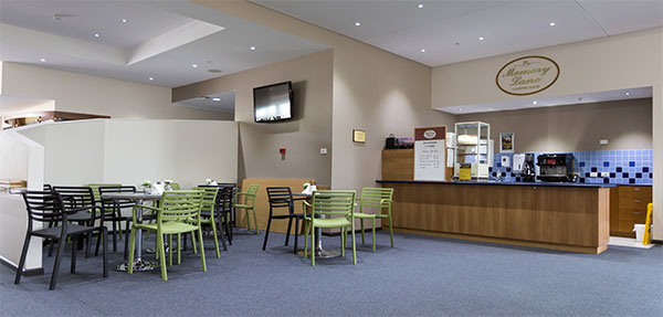
Emmerton Park coffee shop
The Smithton accommodation is located onsite at the Smithton District Hospital and Community Health Service. This accommodation offers students a high level of comfort and amenity as each bedroom has its own ensuite bathroom.
About Smithton
Smithton has a population of about 3300 people and is the main town within the Circular Head Council District, a region which is characterised by lush pastures, rolling green hills, dense temperate rainforests, coastal heathlands, quiet rivers and cascading waterfalls. It is located 246kms from Launceston, 135kms from Devonport and 86kms from Burnie.
The Circular Head region was named by the maritime explorers Matthew Flinders and George Bass on their voyage of discovery in 1798.
The farming area around Smithton has some of the most productive land in Tasmania with thriving dairy, beef and vegetable industries. Sawmills at Smithton supply local, interstate and overseas markets with some of the world's most valued timbers such as sassafras, myrtle and celery-top pine.
Large sections of the nearby State Forests are reserves where visitors can enjoy the serenity and beauty of the rainforests with their fragile and diverse ecosystems. Plants range from the towering eucalypt to the delicate maidenhair fern.
Smithton is on the edge of the Tarkine wilderness area, 350,000ha of remarkably diverse country lying between two of Tasmania's largest rivers, the Pieman and the Arthur, and the largest unprotected wilderness area in the South-East region of Australia. It provides ample opportunities for bushwalking.
Resources
Health Services
St Helens District Hospital
Accommodation at St Helens consists of two houses, both within walking distance of health services and the town centre. Both have WIFI (NBN).
About St Helens
St Helens is the largest town on Tasmania's east coast and it is located 166km east of Launceston. Its main industries are fishing, timber and tourism. St Helens has mild winters and warm summers, the result of a microclimate produced by surrounding hills and warm ocean currents. A deep-sea scale fishing fleet operates out of St Helens and Georges Bay and the area has an enviable reputation for its high quality crayfish and oysters.
There are several good beaches located close to St Helens, suitable for both swimming and surfing.
The St Helens Point State Reserve and the Bay of Fires Coastal Reserve provide walkers with views of spectacular coastal scenery.
St Helens has a number of good restaurants and is well serviced with shops, supermarkets and banks.
Resources
Health Services
- St Helens District Hospital and Community Centre
- Ochre Medical Centre St Helens
- Ernest Targett Pharmacy, 36 Cecilia Street, St Helens
St Marys teaching site
The St Marys Rural Health Teaching Site is next to the Community Health Centre at Gardeners Creek Road, about 500 metres from the centre of St Marys. It provides a high standard of hostel type accommodation with a spacious living area, modern kitchen, and on-site computer and teleconferencing facilities. The RHTS has spectacular views of the mountains to the west, and is an easy drive to some of Tasmania's most popular holiday destinations.
About St Marys
St Marys, with a population of just over 500 people, is situated in the Eastern Highlands at the head of the Break O'Day Plains in the Fingal Valley and provides essential services to the coal mining, forestry and pastoral industries in the region. It is located 130km from Launceston and 220km from Hobart and is easily accessible by road from both the north and south of Tasmania.
St Patricks Head is a striking geological feature of the area and was named by Captain Tobias Furneaux, from the sea, on St Patricks Day in 1773, thirty years before the European settlement of Tasmania. The mountain peak offers spectacular bushwalking opportunities with panoramic views of the rugged East Coast.
St Marys is about 37km from St Helens, the largest town on the East Coast. St Helens has a thriving deep-sea scale fishing industry which operates out of Georges Bay, and has a reputation for fantastic fishing and seafood.
St Marys is within easy travelling distance to the Freycinet Peninsula, the Douglas-Apsley National Park and the world-famous beaches of Wine Glass Bay and the Bay of Fires. It is a popular site for both students and health professionals as it offers the lifestyle, quality medical services and professional staff to ensure that rural health research and learning is an enjoyable and rewarding experience.
Resources
Health Services
Swansea teaching site
The Swansea accommodation is a four-bedroom house located a short walk from the May Shaw Health Centre in Wellington. WIFI (NBN) is provided.
About Swansea
Swansea is located on the north-west shore of Great Oyster Bay, in the centre of Tasmania's east coast. It is 135 km from Hobart and 134 km from Launceston. Swansea has a resident population of approximately 600 people which swells over the summer period. The town has several historic buildings, including Morris' General Store (1838), which has been in operation for over 100 years. It also boasts safe swimming and surfing. Spiky Bridge and Mayfield Beach, south of the town, are excellent for rock and beach fishing. Trout fishing at Lake Leake is also popular.
Towards Lake Leake are the Lost Falls and Meetus Falls. There are two vineyards, Spring Vale and Craigie Knowe, near Cranbrook (just north of Swansea). Close to town is the Swansea Bark Mill, used to process black wattle bark, which was used in pioneering days for tanning leather.
Local services are also provided by the communities of Cranbrook, Lake Leake, Little Swanport, Ponty Pool, Swanick and Coles Bay.
European History
Originally known as Great Swanport, Swansea's story begins with early explorers; among them were Tasman in 1642, Dufresne in 1772, Captain Cox 1879, Nicholas Baudin in 1802 and Amasa Delano in 1803. The nationalities of these explorers (Dutch, French, English, and American) provided a variety of names for local landmarks. Great Swanport was originally established as a garrison, and settlement of the hinterland followed. A convict station was established at Rocky Hills and housed some 400 convicts.
In 1850 the military garrison (a small contingent of the 40th Regiment of Foot) was withdrawn and Swansea became a police district. It remained so until 23rd January 1860 when it became the first rural municipality in Tasmania, with six Councillors. In 1864 the seal of the Municipality was purchased. It was designed by Louisa Anne Meredith and depicted the black swan.
The original settlers of Great Swanport were the Meredith family and the Amos brothers, the Talbot, Buxton and Cotton families who brought their workers and their families, tools, seeds, expertise and their animals. The first farms were complete communities, and were very isolated. The farm industry included orcharding, hop growing, whaling, wool and grain production, beef cattle and sheep hides.
Resources
Health Services
- May Shaw Health Centre
- Community Health Centre – Swansea
- Swansea Pharmacy, 28 Franklin Street, Swansea
- Swansea General Practice, 37 Wellington Street, Swansea
- Swansea Local Government Area Health Services