
Profiles
Arko Lucieer
Arko Lucieer
Head of School and Professor
Geography, Planning, and Spatial Sciences
Room GEO435 , GPSS
+61 3 6226 2140 (phone)
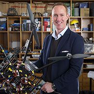
Arko is a Professor in Remote Sensing at The University of Tasmania, Australia. He works within the Surveying and Spatial Sciences group in the School of Technology, Environments and Design. His research focuses on quantitative environmental remote sensing, using satellite and airborne imagery and advanced image processing techniques to better understand the environment. He is the founder and lead investigator of the TerraLuma research group, focusing on the development and application of unmanned aircraft systems (UAS, also known as UAVs or drones) and image processing techniques for environmental, agricultural, and high-precision aerial mapping applications.
Biography
Before joining The University of Tasmania in 2004, Arko was a PhD student at the International Institute for Geo-Information Science and Earth Observation (ITC) and Utrecht University in The Netherlands (2000 – 2004) where he looked at quantifying and visualising uncertainty in image segmentation and classification algorithms. He completed his MSc in Physical Geography at Utrecht University in 2000, specialising in hyperspectral remote sensing and GIS.
Career summary
Qualifications
| PhD in Remote Sensing | Uncertainties in Segmentation and their Visualisation | International Institute for Geo-Information Science and Earth Observation (ITC) and Utrecht University | The Netherlands | 1/10/2004 |
| MSc cum laude in Physical Geography | The DAIS La Peyne experiment: Using the optical and thermal DAIS bands to survey and model the soil surface heat balance | Utrecht University | The Netherlands | 1/09/2000 |
Languages (other than English)
- Dutch: native language
- German: basic
Memberships
Professional practice
- IEEE Geoscience and Remote Sensing Society (GRSS)
- Australian Association for Unmanned Systems (AAUS)
Committee associations
Arko is an Editorial Board member for the following international journals:
- Remote Sensing (since May 2015)
- International Journal of Applied Earth Observation and Geoinformation (June 2012)
- International Journal of Unmanned Systems Engineering (IJUSEng, since Jan 2013)
Administrative expertise
- Management of the TerraLuma research group
- Node leader of the Tasmanian node of the national AusCover project
- Managing research projects (conceptual design, employment, budgets, research direction, outreach)
Academic Coordinator for the Publication Entry System (PES) at UTAS
Teaching
Remote Sensing, Geographical Information Systems (GIS), Spatial Analysis
Teaching expertise
Arko has been a unit coordinator, lecturer, and practical tutor for Remote Sensing and GIS units at the University of Tasmania since 2004.
Teaching responsibility
Arko is the Course Coordinator of the Master of Applied Science (MAppSci) in Environmental Management and Spatial Sciences: K7J4
He is the unit coordinator and lecturer for the following units:
Undergraduate level:
- KGG103 – Remote Sensing: Introduction
- KGG213 – Remote Sensing: Image Analysis
- KGG212 – GIS: Spatial Analysis
- KGG375 – GIS: Advanced Spatial Analysis
Graduate level:
- KGG542 – Environmental Remote Sensing A (co-taught with KGG103)
- KGG543 – Environmental Remote Sensing B (co-taught with KGG213)
- KGG540 – Environmental GIS B (co-taught with KGG212)
- KGG541 – Environmental GIS C (co-taught with KGG375)
- KGG704/KGG705 Master of Applied Science Research Project
- KGG702/KGG708 Master of Applied Science Thesis
And contributes to student supervision in the following undergraduate unit:
KGG355 – Spatial Research Project
Research Appointments
AusCover TAS-node leader: Since 2014 I have been the node leader of the Tasmanian node of the national AusCover remote sensing project, which is part of the Australian Terrestrial Ecosystem Research Network (TERN)
Journal referee: I have been asked to review over 80 papers (19 in 2013, on average 10/year) in high ranking remote sensing and GIS journals, such as Remote Sensing of Environment and IEEE Transactions on Geoscience and Remote Sensing.
Grant referee: Since 2011 I have acted as an ARC reviewer (OzReader) and responsible for review of ARC Discovery, Future Fellowship, Linkage and DECRAs. In 2007 and 2009 I was an international referee for the Antarctic Science Committee and the Research Grants Council (RGC) of Hong Kong, respectively.
Research Invitations
- Keynote at the 3rd International conference on Environmental Monitoring and Assessment, Aarhus, Denmark, 1 – 2 Oct 2015
- International workshop on laser scanning, Cologne, Germany, 16 Mar. 2015
- Geoscience Colloquium University of Cologne, Cologne, Germany, 8 Dec. 2014
- Foresttech 2014, Melbourne, Australia, 25 Nov 2014
- ICASD International Workshop 'UAV-based Remote Sensing Methods for Monitoring Vegetation', Cologne, Germany, 10 Sep. 2013
- ICASD International Workshop 'Low Altitude Remote Sensing for Precision Agriculture', Beijing, China, 1 Dec. 2012
View more on Professor Arko Lucieer in WARP
Expertise
- Environmental and quantitative remote sensing
- Unmanned Aircraft Systems (UAS), Unmanned Aerial Vehicles (UAVs), Remotely Piloted Aircraft Systems (RPAS), drones
- Multispectral, hyperspectral, thermal sensors, sensor integration, sensor calibration, and image correction (geometric, radiometric, and spectral), and derivation of biophysical and biochemical map products
- Laser scanning (LiDAR) and point cloud analysis
- Structure-from-Motion 3D point clouds
- Image classification and machine learning
- Image texture measures
- Geographic object-based image analysis (GEOBIA)
- Change detection
- Terrain analysis
- Advanced spatial analysis and spatial statistics
- Applications: vegetation mapping, landslides, precision agriculture and viticulture, coastal erosion, forestry, Antarctic and sub-Antarctic environments
Research Themes
Arko's research aligns with three University's research themes: Marine, Antarctic and Maritime; Environment, Resources and Sustainability; and Data, Knowledge and Decisions
The TerraLuma research project at the University of Tasmania develops novel tools and algorithms for environmental remote sensing applications and aerial surveys using Unmanned Aircraft Systems (UAS). Up-to-date and accurate spatial data are of crucial importance for sustainable management of our eco- and agrosystems. UAS offer an exciting and novel opportunity to map and understand the environment in greater detail than ever before.
One of the unique aspects of this project is that we operate and integrate multiple sensors to 'make the invisible visible'. These specialised sensor include multispectral and hyperspectral (VNIR), thermal, and LiDAR sensors to map and monitor different aspects of the environment at centimetre resolution on-demand. UAS give the ability to bridge the scale gap between field-based observations and full-scale airborne or satellite observations.
We have worked on a range of applications, including precision agriculture and viticulture; mapping and monitoring vegetation in remote locations such as Antarctica; deriving 3D tree structure for forest inventories; landslide deformation monitoring; 3D stock pile and quarry surveys and volume estimations; assessment of coastal erosion; mapping of geological structures; better understanding functions of natural vegetation communities such as saltmarshes; transforming images into knowledge.
Collaboration
In the past five years, Arko has had research collaborations with CSIRO (Canberra, Australia), University of Wollongong (Australia), University of Cologne (Germany), University of Twente (Netherlands), University of Utrecht (Netherlands), Chinese Agricultural University (Beijing, China), University of Calgary (Canada)The University of Tasmania has supported two professors in remote sensing from The Netherlands to visit and collaborate with his group through the Visiting Scholars and Fellows scheme.
In addition, he has supported five international PhD students with research visits to my lab. He welcomes requests or applications for research visits and collaborations.
Awards
- Between 2006 and 2008, Arko was a co-investigator on the Biodiversity in Grain and Graze: Spatial Analysis, Soil and Invertebrate sub-project (Land and Water Australia: $184K), which won the prestigious Prime Minister's Banksia Environmental Award in July 2008
- Best presentation for established scientist: Strategic Science in Antarctica conference, Hobart, Tasmania, 2013
- Faculty Award for highly cited paper Bergstrom et al. (2009) (relative citation index >8)
- Best pitch award and the overall runner-up award: UniQuest TrailBlazer research commercialisation competition, June 2012
- Best conference presentation award: at the Australasian Remote Sensing and Photogrammetry Conference (ARSPC 2008), Darwin, Australia, July 2008.
Current projects
Arko's current focus is on the use of UAS for the assessment of sun-induced chlorophyll fluorescence funded by an ARC Discovery project. He is involved in a project that looks at UAS-borne LiDAR for characterisation of forest structure. He leads a project on the use of UAS in Antarctica to study the health of moss beds with hyperspectral UAS remote sensing funded by the Australian Antarctic Science Grant scheme. Finally, Arko leads several active projects that focus on UAS for precision agriculture and viticulture, and landslide deformation monitoring. For more information see:http://www.terraluma.net.
Fields of Research
- Photogrammetry and remote sensing (401304)
- Physical geography and environmental geoscience (370999)
- Forestry management and environment (300707)
- Geospatial information systems and geospatial data modelling (401302)
- Terrestrial ecology (310308)
- Landscape ecology (410206)
- Sensor technology (incl. chemical aspects) (340108)
- Agriculture, land and farm management (300299)
- Geomorphology and earth surface processes (370901)
- Ecological impacts of climate change and ecological adaptation (410102)
- Natural resource management (410406)
- Pollution and contamination (410599)
- Biosecurity science and invasive species ecology (410202)
- Human information interaction and retrieval (461003)
- Agricultural spatial analysis and modelling (300206)
- Crop and pasture biochemistry and physiology (300404)
- Instrumental methods (excl. immunological and bioassay methods) (340105)
- Marine and estuarine ecology (incl. marine ichthyology) (310305)
- Environmental management (410404)
- Tree improvement (incl. selection and breeding) (300709)
- Population ecology (310307)
- Genetics (310599)
- Volcanology (370512)
- Agricultural land management (300202)
- Conservation and biodiversity (410401)
- Ecological applications (410299)
- Fire ecology (410205)
- Vertebrate biology (310914)
- Environmental management (410499)
- Analytical spectrometry (340101)
- Aboriginal and Torres Strait Islander environmental knowledges (450304)
- Physical oceanography (370803)
- Information modelling, management and ontologies (460903)
- Geomatic engineering (401399)
- Analog electronics and interfaces (400901)
- Horticultural crop growth and development (300802)
- Image processing (460306)
- Other earth sciences (379999)
- Horticultural crop protection (incl. pests, diseases and weeds) (300804)
- Community ecology (excl. invasive species ecology) (310302)
- Ecological physiology (310303)
- Surveying (incl. hydrographic surveying) (401306)
- Forest ecosystems (300703)
- Ecosystem function (410203)
- Wildlife and habitat management (410407)
- Agricultural biotechnology (300199)
- Environmental assessment and monitoring (410402)
- Photovoltaic devices (solar cells) (400910)
- Navigation and position fixing (401303)
- Sustainable agricultural development (300210)
- Environmental rehabilitation and restoration (410405)
- Agronomy (300403)
- Aquaculture and fisheries stock assessment (300502)
- Biological adaptation (310403)
- Global change biology (319902)
- Forestry fire management (300706)
- Human impacts of climate change and human adaptation (410103)
- Surface water hydrology (370704)
- Climate change science (370299)
- Soil physics (410605)
- Agricultural engineering (409901)
- Wood fibre processing (300711)
- Oenology and viticulture (300805)
- Plant physiology (310806)
- Climate change impacts and adaptation (410199)
- Natural hazards (370903)
- Environmental education and extension (410403)
- Visual effects (360506)
- Wood processing (300712)
- Evolutionary impacts of climate change (310406)
- Other environmental sciences (419999)
- Aerospace engineering (400199)
- Applications in life sciences (460103)
- Computer vision (460304)
Research Objectives
- Assessment and management of coastal and estuarine ecosystems (180201)
- Assessment and management of terrestrial ecosystems (180601)
- Expanding knowledge in the environmental sciences (280111)
- Other environmental management (189999)
- Assessment and management of freshwater ecosystems (180301)
- Application software packages (220401)
- Terrestrial biodiversity (180606)
- Assessment and management of Antarctic and Southern Ocean ecosystems (180403)
- Biodiversity in Antarctic and Southern Ocean environments (180404)
- Softwood plantations (260205)
- Social impacts of climate change and variability (190103)
- Evaluation, allocation, and impacts of land use (180603)
- Rehabilitation or conservation of terrestrial environments (180604)
- Effects of climate change on Antarctic and sub-Antarctic environments (excl. social impacts) (190503)
- Expanding knowledge in the earth sciences (280107)
- Climatological hazards (e.g. extreme temperatures, drought and wildfires) (190401)
- Information systems, technologies and services (220499)
- Plant extract crops (260606)
- Sown pastures (excl. lucerne) (100505)
- Forestry (260299)
- Native forests (260204)
- Management of water consumption by plant production (260104)
- Air quality (180101)
- Terrestrial systems and management (180699)
- Control of pests, diseases and exotic species in terrestrial environments (180602)
- Expanding knowledge in the chemical sciences (280105)
- Management of Antarctic and Southern Ocean environments (180499)
- Assessment and management of benthic marine ecosystems (180501)
- Expanding knowledge in the agricultural, food and veterinary sciences (280101)
- Natural hazards (190499)
- Ecosystem adaptation to climate change (190102)
- Tree nuts (excl. almonds and macadamias) (260515)
- Hardwood plantations (260201)
- Environmentally sustainable plant production (260199)
- Climate change mitigation strategies (190301)
- Other information and communication services (229999)
- Environmentally sustainable information and communication services (220299)
- Horticultural crops (260599)
- Expanding knowledge in the physical sciences (280120)
- Scientific instruments (241003)
- Understanding climate change (190599)
- Climate change adaptation measures (excl. ecosystem) (190101)
- Wine grapes (260608)
- Coastal and estuarine systems and management (180299)
- Timber materials (120306)
- Other plant production and plant primary products (269999)
- Soybeans (260311)
- Sustainability indicators (190209)
- Understanding the impact of natural hazards caused by climate change (190508)
- Field grown vegetable crops (260505)
- Maize (260306)
- Climate change models (190501)
- Marine biodiversity (180504)
- Cannabis (260601)
- Protection and conservation of Antarctic and Southern Ocean environments (180406)
- Visual communication (130205)
- The creative arts (130103)
- Stone fruit (excl. avocado) (260513)
- Carbon capture and storage (170302)
Publications
A complete overview of my publication record can be found on the WARP database.
An overview of my research funding can also be found on the WARP database.
Citation Summary (statistics from 21 May 2015): Of 83 publications (2001-2015), Arko has published 36 international peer-refereed papers, 4 refereed book chapters, 11 full-refereed conference papers, 18 full conference papers, and 12 consultancy reports. The total number of citations to my publications is: 692 (Scopus), 1289 (Google Scholar). His Hirsch-index (h-Index) is 14 (Scopus), 18 (Google Scholar) with two key first author papers cited 60 and 44 times respectively. Over the last five years he has published on average 6.2 peer-refereed papers per year and his upward trajectory in research output is demonstrated by a publication rate of 19 peer-reviewed papers since 2012. Arko has consistently published in the top quartile of journals in the remote sensing category (JCR and InCites 15/05/2015).
Total publications
171
Highlighted publications
(11 outputs)| Year | Type | Citation | Altmetrics |
|---|---|---|---|
| 2014 | Journal Article | Lucieer A, de Jong SM, Turner D, 'Mapping landslide displacements using Structure from Motion (SfM) and image correlation of multi-temporal UAV photography', Progress in Physical Geography, 38, (1) pp. 97-116. ISSN 0309-1333 (2014) [Refereed Article] DOI: 10.1177/0309133313515293 [eCite] [Details] Citations: Scopus - 520Web of Science - 462 Co-authors: Turner D | |
| 2014 | Journal Article | Lucieer A, Malenovsky Z, Veness T, Wallace L, 'HyperUAS - imaging spectroscopy from a multirotor unmanned aircraft system', Journal of Field Robotics, 31, (4) pp. 571-590. ISSN 1556-4959 (2014) [Refereed Article] DOI: 10.1002/rob.21508 [eCite] [Details] Citations: Scopus - 146Web of Science - 130 Co-authors: Malenovsky Z; Veness T; Wallace L | |
| 2014 | Journal Article | Lucieer A, Turner D, King DH, Robinson SA, 'Using an Unmanned Aerial Vehicle (UAV) to capture micro-topography of Antarctic moss beds', International Journal of Applied Earth Observation and Geoinformation, 27, (A) pp. 53-62. ISSN 0303-2434 (2014) [Refereed Article] DOI: 10.1016/j.jag.2013.05.011 [eCite] [Details] Citations: Scopus - 203Web of Science - 181 Co-authors: Turner D | |
| 2014 | Journal Article | Turner D, Lucieer A, Wallace L, 'Direct georeferencing of ultrahigh-resolution UAV imagery', IEEE Transactions on Geoscience and Remote Sensing, 52, (5) pp. 2738-2745. ISSN 0196-2892 (2014) [Refereed Article] DOI: 10.1109/TGRS.2013.2265295 [eCite] [Details] Citations: Scopus - 318Web of Science - 275 Co-authors: Turner D; Wallace L | |
| 2012 | Journal Article | Kelcey J, Lucieer A, 'Sensor Correction of a 6-Band Multispectral Imaging Sensor for UAV Remote Sensing', Remote Sensing, 4, (5) pp. 1462-1493. ISSN 2072-4292 (2012) [Refereed Article] DOI: 10.3390/rs4051462 [eCite] [Details] Citations: Scopus - 187Web of Science - 160 Co-authors: Kelcey J | |
| 2012 | Journal Article | Wallace L, Lucieer A, Watson C, Turner D, 'Development of a UAV-LiDAR System with application to forest inventory', Remote Sensing, 4, (6) pp. 1519-1543. ISSN 2072-4292 (2012) [Refereed Article] DOI: 10.3390/rs4061519 [eCite] [Details] Citations: Scopus - 489Web of Science - 422 Co-authors: Wallace L; Watson C; Turner D | |
| 2009 | Journal Article | Bergstrom DM, Lucieer A, Kiefer K, Wasley J, Belbin L, et al., 'Indirect effects of invasive species removal devastate World Heritage Island', Journal of Applied Ecology, 46, (1) pp. 73-81. ISSN 0021-8901 (2009) [Refereed Article] DOI: 10.1111/j.1365-2664.2008.01601.x [eCite] [Details] Citations: Scopus - 303Web of Science - 273 Co-authors: Pedersen TK | |
| 2005 | Journal Article | Lucieer A, Stein A, 'Texture-based landform segmentation of LiDAR imagery', International Journal of Applied Earth Observation and Geoinformation, 6, (3-4) pp. 261-270. ISSN 0303-2434 (2005) [Refereed Article] DOI: 10.1016/j.jag.2004.10.008 [eCite] [Details] Citations: Scopus - 52Web of Science - 42 | |
| 2005 | Journal Article | Lucieer A, Stein A, Fisher P, 'Multivariate texture-based segmentation of remotely sensed imagery for extraction of objects and their uncertainty', International Journal of Remote Sensing, 26, (14) pp. 2917-2936. ISSN 0143-1161 (2005) [Refereed Article] DOI: 10.1080/01431160500057723 [eCite] [Details] Citations: Scopus - 95Web of Science - 79 | |
| 2004 | Journal Article | Lucieer A, Kraak MJ, 'Interactive and visual fuzzy classification of remotely sensed imagery for exploration of uncertainty', International Journal of Geographical Information Science, 18, (5) pp. 491-512. ISSN 1365-8816 (2004) [Refereed Article] DOI: 10.1080/13658810410001658094 [eCite] [Details] Citations: Scopus - 35Web of Science - 26 | |
| 2002 | Journal Article | Lucieer A, Stein A, 'Existential uncertainty of spatial objects segmented from satellite sensor Imagery', IEEE Transactions on Geoscience and Remote Sensing, 40, (11) pp. 2518-2521. ISSN 0196-2892 (2002) [Refereed Article] DOI: 10.1109/TGRS.2002.805072 [eCite] [Details] Citations: Scopus - 75Web of Science - 68 |
Journal Article
(99 outputs)| Year | Citation | Altmetrics |
|---|---|---|
| 2023 | Bowman DMJS, Ondei S, Lucieer A, Foyster S, Prior LD, 'Forest‑sedgeland boundaries are historically stable and resilient to wildfre at Blakes Opening in the Tasmanian Wilderness World Heritage Area, Australia', Landscape Ecology, 38 pp. 205-222. ISSN 1572-9761 (2023) [Refereed Article] DOI: 10.1007/s10980-022-01558-x [eCite] [Details] Co-authors: Bowman DMJS; Ondei S; Foyster S; Prior LD | |
| 2022 | Yadev BKV, Lucieer A, Jordan GJ, Baker SC, 'Using topographic attributes to predict the density of vegetation layers in a wet eucalypt forest', Australian Forestry, 85, (1) pp. 25-37. ISSN 0004-9158 (2022) [Refereed Article] DOI: 10.1080/00049158.2021.2004687 [eCite] [Details] Citations: Scopus - 1Web of Science - 1 Co-authors: Yadev BKV; Jordan GJ; Baker SC | |
| 2021 | Camarretta N, Harrison PA, Lucieer A, Potts BM, Davidson N, et al., 'Handheld laser scanning detects spatiotemporal differences in the development of structural traits among species in restoration plantings', Remote Sensing, 13, (9) Article 1706. ISSN 2072-4292 (2021) [Refereed Article] DOI: 10.3390/rs13091706 [eCite] [Details] Citations: Scopus - 8Web of Science - 5 Co-authors: Camarretta N; Harrison PA; Potts BM; Hunt M | |
| 2021 | Harrison PA, Camarretta N, Krisanski S, Bailey TG, Davidson NJ, et al., 'From communities to individuals: using remote sensing to inform and monitor woodland restoration', Ecological Management and Restoration, 22, (S2) pp. 127-139. ISSN 1442-8903 (2021) [Refereed Article] DOI: 10.1111/emr.12505 [eCite] [Details] Citations: Scopus - 4Web of Science - 4 Co-authors: Harrison PA; Camarretta N; Krisanski S; Bailey TG; Davidson NJ; Bain G; Hamer R; Gardiner R; Proft K; Taskhiri MS; Turner P; Turner D | |
| 2021 | Hillman S, Hally B, Wallace L, Turner D, Lucieer A, et al., 'High-resolution estimates of fire severity - an evaluation of UAS image and LiDAR mapping approaches on a sedgeland forest boundary in Tasmania, Australia', Fire, 4, (1) Article 14. ISSN 2571-6255 (2021) [Refereed Article] DOI: 10.3390/fire4010014 [eCite] [Details] Citations: Scopus - 12Web of Science - 11 Co-authors: Wallace L; Turner D | |
| 2021 | Hillman S, Wallace L, Lucieer A, Reinke K, Turner D, et al., 'A comparison of terrestrial and UAS sensors for measuring fuel hazard in a dry sclerophyll forest', International Journal of Applied Earth Observation and Geoinformation, 95 pp. 1-13. ISSN 1569-8432 (2021) [Refereed Article] DOI: 10.1016/j.jag.2020.102261 [eCite] [Details] Citations: Scopus - 12Web of Science - 13 Co-authors: Wallace L; Turner D | |
| 2021 | Iqbal IA, Osborn J, Stone C, Lucieer A, 'A comparison of ALS and dense photogrammetric point clouds for individual tree detection in radiata pine plantations', Remote Sensing, 13, (17) Article 3536. ISSN 2072-4292 (2021) [Refereed Article] DOI: 10.3390/rs13173536 [eCite] [Details] Citations: Scopus - 1Web of Science - 1 Co-authors: Iqbal IA; Osborn J | |
| 2021 | Jaskierniak D, Lucieer A, Kuczera G, Turner D, Lane PNJ, et al., 'Individual tree detection and crown delineation from unmanned aircraft system (UAS) LiDAR in structurally complex mixed species eucalypt forests', ISPRS Journal of Photogrammetry and Remote Sensing, 171 pp. 171-187. ISSN 0924-2716 (2021) [Refereed Article] DOI: 10.1016/j.isprsjprs.2020.10.016 [eCite] [Details] Citations: Scopus - 26Web of Science - 25 Co-authors: Turner D | |
| 2021 | Montes Herrera JC, Cimoli E, Cummings V, Hill N, Lucieer A, et al., 'Underwater Hyperspectral Imaging (UHI): a review of systems and applications for proximal seafloor ecosystem studies', Remote Sensing, 13, (17) Article 3451. ISSN 2072-4292 (2021) [Refereed Article] DOI: 10.3390/rs13173451 [eCite] [Details] Citations: Scopus - 6Web of Science - 5 Co-authors: Montes Herrera JC; Cimoli E; Hill N; Lucieer V | |
| 2021 | Togeiro de Alckmin G, Kooistra L, Rawnsley R, Lucieer A, 'Comparing methods to estimate perennial ryegrass biomass: Canopy height and spectral vegetation indices', Precision Agriculture, 22 pp. 205-225. ISSN 1385-2256 (2021) [Refereed Article] DOI: 10.1007/s11119-020-09737-z [eCite] [Details] Citations: Scopus - 15Web of Science - 16 Co-authors: Togeiro de Alckmin G; Rawnsley R | |
| 2021 | Virtue J, Turner D, Williams G, Zeliadt S, McCabe M, et al., 'Thermal sensor calibration for unmanned aerial systems using an external heated shutter', Drones, 5, (4) Article 119. ISSN 2504-446X (2021) [Refereed Article] DOI: 10.3390/drones5040119 [eCite] [Details] Citations: Scopus - 7Web of Science - 5 Co-authors: Virtue J; Turner D | |
| 2021 | Yadav BKV, Lucieer A, Baker SC, Jordan GJ, 'Tree crown segmentation and species classification in a wet eucalypt forest from airborne hyperspectral and LiDAR data', International Journal of Remote Sensing, 42, (20) pp. 7952-7977. ISSN 0143-1161 (2021) [Refereed Article] DOI: 10.1080/01431161.2021.1956699 [eCite] [Details] Citations: Scopus - 5Web of Science - 5 Co-authors: Yadav BKV; Baker SC; Jordan GJ | |
| 2020 | Angel Y, Turner D, Parkes S, Malbeteau Y, Lucieer A, et al., 'Automated georectification and mosaicking of UAV-based hyperspectral imagery from push-broom sensors', Remote Sensing, 12, (1) Article 34. ISSN 2072-4292 (2020) [Refereed Article] DOI: 10.3390/RS12010034 [eCite] [Details] Citations: Scopus - 23Web of Science - 21 Co-authors: Turner D | |
| 2020 | Aragon B, Johansen K, Parkes S, Malbeteau Y, Al-Mashharawi S, et al., 'A calibration procedure for field and UAV-based uncooled thermal infrared instruments', Sensors, 20, (11) Article 3316. ISSN 1424-8220 (2020) [Refereed Article] DOI: 10.3390/s20113316 [eCite] [Details] Citations: Scopus - 33Web of Science - 30 Co-authors: Turner D | |
| 2020 | Bendig J, Malenovsky Z, Gautam D, Lucieer A, 'Solar-induced chlorophyll fluorescence measured from an unmanned aircraft system: sensor etaloning and platform notion correction', IEEE Transactions on Geoscience and Remote Sensing, 58, (5) pp. 3437-3444. ISSN 0196-2892 (2020) [Refereed Article] DOI: 10.1109/TGRS.2019.2956194 [eCite] [Details] Citations: Scopus - 17Web of Science - 17 Co-authors: Bendig J; Malenovsky Z | |
| 2020 | Camarretta N, Harrison PA, Bailey T, Davidson N, Lucieer A, et al., 'Stability of species and provenance performance when translocated into different community assemblages', Restoration Ecology, 28, (2) pp. 447-458. ISSN 1061-2971 (2020) [Refereed Article] DOI: 10.1111/rec.13098 [eCite] [Details] Citations: Scopus - 8Web of Science - 8 Co-authors: Camarretta N; Harrison PA; Bailey T; Hunt MA; Potts BM | |
| 2020 | Camarretta N, Harrison PA, Bailey T, Potts B, Lucieer A, et al., 'Monitoring forest structure to guide adaptive management of forest restoration: a review of remote sensing approaches', New Forests, 51 pp. 573-596. ISSN 0169-4286 (2020) [Refereed Article] DOI: 10.1007/s11056-019-09754-5 [eCite] [Details] Citations: Scopus - 52Web of Science - 55 Co-authors: Camarretta N; Harrison PA; Bailey T; Potts B; Hunt M | |
| 2020 | Camarretta N, Harrison PA, Lucieer A, Potts BM, Davidson N, et al., 'From drones to phenotype: Using UAV-LiDAR to detect species and provenance variation in tree productivity and structure', Remote Sensing, 12, (19) Article 3184. ISSN 2072-4292 (2020) [Refereed Article] DOI: 10.3390/rs12193184 [eCite] [Details] Citations: Scopus - 22Web of Science - 22 Co-authors: Camarretta N; Harrison PA; Potts BM; Hunt M | |
| 2020 | Cimoli E, Lucieer V, Meiners KM, Chennu A, Castrisios K, et al., 'Mapping the in situ microspatial distribution of ice algal biomass through hyperspectral imaging of sea-ice cores', Scientific Reports, 10, (1) Article 21848. ISSN 2045-2322 (2020) [Refereed Article] DOI: 10.1038/s41598-020-79084-6 [eCite] [Details] Citations: Scopus - 9Web of Science - 9 Co-authors: Cimoli E; Lucieer V; Meiners KM; Castrisios K; Martin A; Kennedy F | |
| 2020 | Gautam D, Lucieer A, Bendig J, Malenovsky Z, 'Footprint determination of a spectroradiometer mounted on an unmanned aircraft system', IEEE Transactions on Geoscience and Remote Sensing, 58, (5) pp. 3085-3096. ISSN 0196-2892 (2020) [Refereed Article] DOI: 10.1109/TGRS.2019.2947703 [eCite] [Details] Citations: Scopus - 11Web of Science - 12 Co-authors: Bendig J; Malenovsky Z | |
| 2020 | Grubinger S, Coops NC, Stoehr M, El-Kassaby YA, Lucieer A, et al., 'Modeling realized gains in Douglas-fir (Pseudotsuga menziesii) using laser scanning data from unmanned aircraft systems (UAS)', Forest Ecology and Management, 473 Article 118284. ISSN 0378-1127 (2020) [Refereed Article] DOI: 10.1016/j.foreco.2020.118284 [eCite] [Details] Citations: Scopus - 9Web of Science - 7 Co-authors: Turner D | |
| 2020 | Iqbal F, Lucieer A, Barry K, 'Prediction of poppy thebaine alkaloid concentration using UAS remote sensing', Precision Agriculture, 21 pp. 1045-1056. ISSN 1385-2256 (2020) [Refereed Article] DOI: 10.1007/s11119-020-09707-5 [eCite] [Details] Co-authors: Iqbal F; Barry K | |
| 2020 | KIng DH, Wasley J, Ashcroft MB, Ryan-Colton E, Lucieer A, et al., 'Semi-automated analysis of digital photographs for monitoring East Antarctic vegetation', Frontiers in Plant Science, 11 Article 766. ISSN 1664-462X (2020) [Refereed Article] DOI: 10.3389/fpls.2020.00766 [eCite] [Details] Citations: Scopus - 7Web of Science - 5 | |
| 2020 | Madsen B, Treier UA, Zlinszky A, Lucieer A, Normand S, 'Detecting shrub encroachment in seminatural grasslands using UAS LiDAR', Ecology and Evolution, 10, (11) pp. 4876-4902. ISSN 2045-7758 (2020) [Refereed Article] DOI: 10.1002/ece3.6240 [eCite] [Details] Citations: Scopus - 17Web of Science - 16 | |
| 2020 | Mahbub P, Noori A, Parry JS, Davis J, Lucieer A, et al., 'Continuous and real-time indoor and outdoor methane sensing with portable optical sensor using rapidly pulsed IR LEDs', Talanta, 218 Article 121144. ISSN 0039-9140 (2020) [Refereed Article] DOI: 10.1016/j.talanta.2020.121144 [eCite] [Details] Citations: Scopus - 13Web of Science - 12 Co-authors: Mahbub P; Noori A; Parry JS; Davis J; Macka M | |
| 2020 | Togeiro de Alckmin G, Kooistra L, Rawnsley R, de Bruin S, Lucieer A, 'Retrieval of hyperspectral information from multispectral data for perennial ryegrass biomass estimation', Sensors, 20, (24) Article 7192. ISSN 1424-8220 (2020) [Refereed Article] DOI: 10.3390/s20247192 [eCite] [Details] Citations: Scopus - 3Web of Science - 1 Co-authors: Togeiro de Alckmin G; Rawnsley R | |
| 2020 | Togeiro de Alckmin G, Lucieer A, Roerink G, Rawnsley R, Hoving I, et al., 'Retrieval of crude protein in perennial ryegrass using spectral data at the canopy level', Remote Sensing, 12, (18) Article 2958. ISSN 2072-4292 (2020) [Refereed Article] DOI: 10.3390/rs12182958 [eCite] [Details] Citations: Web of Science - 3 Co-authors: Togeiro de Alckmin G; Rawnsley R | |
| 2020 | du Toit F, Coops NC, Tompalski P, Goodbody TRH, El-Kassaby YA, et al., 'Characterizing variations in growth characteristics between Douglas-fir with different genetic gain levels using airborne laser scanning', Trees, 34, (3) pp. 649-664. ISSN 0931-1890 (2020) [Refereed Article] DOI: 10.1007/s00468-019-01946-y [eCite] [Details] Citations: Scopus - 12Web of Science - 13 Co-authors: Turner D | |
| 2019 | Cimoli E, Meiners KM, Lucieer A, Lucieer V, 'An under-ice hyperspectral and RGB imaging system to capture fine-scale biophysical properties of sea ice', Remote Sensing, 11, (23) Article 2860. ISSN 2072-4292 (2019) [Refereed Article] DOI: 10.3390/rs11232860 [eCite] [Details] Citations: Scopus - 11Web of Science - 11 Co-authors: Cimoli E; Meiners KM; Lucieer V | |
| 2019 | Gautam D, Lucieer A, Watson C, McCoull C, 'Lever-arm and boresight correction, and field of view determination of a spectroradiometer mounted on an unmanned aircraft system', ISPRS Journal of Photogrammetry and Remote Sensing, 155, (September 2019) pp. 25-36. ISSN 0924-2716 (2019) [Refereed Article] DOI: 10.1016/j.isprsjprs.2019.06.016 [eCite] [Details] Citations: Scopus - 16Web of Science - 17 Co-authors: Gautam D; Watson C; McCoull C | |
| 2019 | Iqbal IA, Musk RA, Osborn J, Stone C, Lucieer A, 'A comparison of area-based forest attributes derived from airborne laser scanner, small-format and medium-format digital aerial photography', International Journal of Applied Earth Observation and Geoinformation, 76 pp. 231-241. ISSN 0303-2434 (2019) [Refereed Article] DOI: 10.1016/j.jag.2018.12.002 [eCite] [Details] Citations: Scopus - 17Web of Science - 17 Co-authors: Iqbal IA; Osborn J | |
| 2019 | Melville B, Fisher A, Lucieer A, 'Ultra-high spatial resolution fractional vegetation cover from unmanned aerial multispectral imagery', International Journal of Applied Earth Observation and Geoinformation, 78 pp. 14-24. ISSN 0303-2434 (2019) [Refereed Article] DOI: 10.1016/j.jag.2019.01.013 [eCite] [Details] Citations: Scopus - 27Web of Science - 24 Co-authors: Melville B | |
| 2019 | Melville B, Lucieer A, Aryal J, 'Classification of lowland native grassland communities using hyperspectral Unmanned Aircraft System (UAS) Imagery in the Tasmanian midlands', Drones, 3, (1) Article 5. ISSN 2504-446X (2019) [Refereed Article] DOI: 10.3390/drones3010005 [eCite] [Details] Citations: Scopus - 24Web of Science - 23 Co-authors: Melville B; Aryal J | |
| 2019 | Noori A, Mahbub P, Parry JS, Davis J, Lucieer A, et al., 'Portable device for continuous sensing with rapidly pulsed LEDs - Part1: rapid on-the-fly processing of large data streams using an open source microcontroller with field programmable gate array', Measurement, 146 pp. 749-757. ISSN 0263-2241 (2019) [Refereed Article] DOI: 10.1016/j.measurement.2019.05.034 [eCite] [Details] Citations: Scopus - 3Web of Science - 2 Co-authors: Noori A; Mahbub P; Parry JS; Davis J; Macka M | |
| 2019 | Rajbhandari S, Aryal J, Osborn J, Lucieer A, Musk R, 'Leveraging machine learning to extend Ontology-Driven Geographic Object-Based Image Analysis (O-GEOBIA): a case study in forest-type mapping', Remote Sensing, 11, (5) Article 503. ISSN 2072-4292 (2019) [Refereed Article] DOI: 10.3390/rs11050503 [eCite] [Details] Citations: Scopus - 21Web of Science - 18 Co-authors: Rajbhandari S; Aryal J; Osborn J; Musk R | |
| 2019 | Roodposhti MS, Aryal J, Lucieer A, Bryan BA, 'Uncertainty assessment of hyperspectral image classification: Deep learning vs. random forest', Entropy, 21, (1) Article 78. ISSN 1099-4300 (2019) [Refereed Article] DOI: 10.3390/e21010078 [eCite] [Details] Citations: Scopus - 25Web of Science - 22 Co-authors: Aryal J | |
| 2019 | Roodposhti MS, Lucieer A, Anees A, Bryan BA, 'A robust rule-based ensemble framework using mean-shift segmentation for hyperspectral image classification', Remote Sensing, 11, (17) Article 2057. ISSN 2072-4292 (2019) [Refereed Article] DOI: 10.3390/rs11172057 [eCite] [Details] Citations: Scopus - 7Web of Science - 6 Co-authors: Anees A | |
| 2019 | Turner DJ, Malenovsky Z, Lucieer A, Turnbull JD, Robinson SA, 'Optimizing spectral and spatial resolutions of unmanned aerial system imaging sensors for monitoring Antarctic vegetation', IEEE Journal of Selected Topics in Applied Earth Observations and Remote Sensing, 12, (10) pp. 3813-3825. ISSN 1939-1404 (2019) [Refereed Article] DOI: 10.1109/JSTARS.2019.2938544 [eCite] [Details] Citations: Scopus - 12Web of Science - 12 Co-authors: Turner DJ; Malenovsky Z | |
| 2018 | Aasen H, Honkavaara E, Lucieer A, Zarco-Tejada PJ, 'Quantitative remote sensing at ultra-high resolution with UAV spectroscopy: A review of sensor technology, measurement procedures, and data correctionworkflows', Remote Sensing, 10, (7) Article 1091. ISSN 2072-4292 (2018) [Refereed Article] DOI: 10.3390/rs10071091 [eCite] [Details] Citations: Scopus - 317Web of Science - 282 | |
| 2018 | Gautam D, Watson C, Lucieer A, Malenovsky Z, 'Error budget for geolocation of spectroradiometer point observations from an Unmanned Aircraft System', Sensors, 18, (10) Article 3465. ISSN 1424-8220 (2018) [Refereed Article] DOI: 10.3390/s18103465 [eCite] [Details] Citations: Scopus - 9Web of Science - 8 Co-authors: Gautam D; Watson C; Malenovsky Z | |
| 2018 | Iqbal F, Lucieer A, Barry K, 'Simplified radiometric calibration for UAS-mounted multispectral sensor', European Journal of Remote Sensing, 51, (1) pp. 301-313. ISSN 2279-7254 (2018) [Refereed Article] DOI: 10.1080/22797254.2018.1432293 [eCite] [Details] Citations: Scopus - 58Web of Science - 58 Co-authors: Barry K | |
| 2018 | Iqbal F, Lucieer A, Barry K, 'Poppy crop capsule volume estimation using UAS remote sensing and random forest regression', International Journal of Applied Earth Observation and Geoinformation, 73 pp. 362-373. ISSN 0303-2434 (2018) [Refereed Article] DOI: 10.1016/j.jag.2018.06.008 [eCite] [Details] Citations: Scopus - 14Web of Science - 13 Co-authors: Barry K | |
| 2018 | Iqbal IA, Osborn J, Stone C, Lucieer A, Dell M, et al., 'Evaluating the robustness of point clouds from small format aerial photography over a Pinus radiata plantation', Australian Forestry, 81, (3) pp. 162-176. ISSN 0004-9158 (2018) [Refereed Article] DOI: 10.1080/00049158.2018.1482799 [eCite] [Details] Citations: Scopus - 10Web of Science - 11 Co-authors: Iqbal IA; Osborn J; McCoull C | |
| 2018 | Melville B, Lucieer A, Aryal J, 'Object-based random forest classification of Landsat ETM+ and WorldView-2 satellite imagery for mapping lowland native grassland communities in Tasmania, Australia', International Journal of Applied Earth Observation and Geoinformation, 66 pp. 46-55. ISSN 1569-8432 (2018) [Refereed Article] DOI: 10.1016/j.jag.2017.11.006 [eCite] [Details] Citations: Scopus - 41Web of Science - 33 Co-authors: Melville B; Aryal J | |
| 2018 | Melville B, Lucieer A, Aryal J, 'Assessing the impact of spectral resolution on classification of lowland native grassland communities based on field spectroscopy in Tasmania, Australia', Remote Sensing, 10, (2) Article 308. ISSN 2072-4292 (2018) [Refereed Article] DOI: 10.3390/rs10020308 [eCite] [Details] Citations: Scopus - 12Web of Science - 13 Co-authors: Melville B; Aryal J | |
| 2018 | Noori A, Mahbub P, Dvorak M, Lucieer A, Macka M, 'Radiometric analysis of UV to near infrared LEDs for optical sensing and radiometric measurements in photochemical systems', Sensors and Actuators B: Chemical, 262 pp. 171-179. ISSN 0925-4005 (2018) [Refereed Article] DOI: 10.1016/j.snb.2018.01.179 [eCite] [Details] Citations: Scopus - 15Web of Science - 16 Co-authors: Noori A; Mahbub P; Dvorak M; Macka M | |
| 2018 | Staben GW, Lucieer A, Scarth P, 'Modelling LiDAR derived tree canopy height from Landsat TM, ETM plus and OLI satellite imagery - A machine learning approach', International Journal of Applied Earth Observation and Geoinformation, 73 pp. 666-681. ISSN 0303-2434 (2018) [Refereed Article] DOI: 10.1016/j.jag.2018.08.013 [eCite] [Details] Citations: Scopus - 25Web of Science - 24 | |
| 2018 | Turner D, Lucieer A, Malenovsky Z, King D, Robinson SA, 'Assessment of Antarctic moss health from multi-sensor UAS imagery with random forest modelling', International Journal of Applied Earth Observation and Geoinformation, 68 pp. 168-179. ISSN 1569-8432 (2018) [Refereed Article] DOI: 10.1016/j.jag.2018.01.004 [eCite] [Details] Citations: Scopus - 33Web of Science - 33 Co-authors: Turner D; Malenovsky Z | |
| 2018 | de Roos S, Turner D, Lucieer A, Bowman DMJS, 'Using digital surface models from UAS imagery of fire damaged sphagnum peatlands for monitoring and hydrological restoration', Drones, 2, (4) Article 45. ISSN 2511-8439 (2018) [Refereed Article] DOI: 10.3390/drones2040045 [eCite] [Details] Citations: Scopus - 8Web of Science - 6 Co-authors: Turner D; Bowman DMJS | |
| 2017 | Cimoli E, Lucieer A, Meiners KM, Lund-Hansen LC, Kennedy F, et al., 'Towards improved estimates of sea-ice algal biomass: experimental assessment of hyperspectral imaging cameras for under-ice studies', Annals of Glaciology, 58, (75 pt1) pp. 68-77. ISSN 0260-3055 (2017) [Refereed Article] DOI: 10.1017/aog.2017.6 [eCite] [Details] Citations: Scopus - 9Web of Science - 10 Co-authors: Cimoli E; Meiners KM; Kennedy F; Martin A; McMinn A; Lucieer V | |
| 2017 | Gautam D, Lucieer A, Malenovsky Z, Watson C, 'Comparison of MEMS-based and FOG-based IMUs to determine sensor pose on an unmanned aircraft system', Journal of Surveying Engineering, 143, (4) Article 04017009. ISSN 0733-9453 (2017) [Refereed Article] DOI: 10.1061/(ASCE)SU.1943-5428.0000225 [eCite] [Details] Citations: Scopus - 12Web of Science - 11 Co-authors: Gautam D; Watson C | |
| 2017 | Iqbal F, Lucieer A, Barry K, Wells R, 'Poppy crop height and capsule volume estimation from a single UAS flight', Remote Sensing, 9, (7) Article 647. ISSN 2072-4292 (2017) [Refereed Article] DOI: 10.3390/rs9070647 [eCite] [Details] Citations: Scopus - 33Web of Science - 30 Co-authors: Barry K; Wells R | |
| 2017 | Malenovsky Z, Lucieer A, King DH, Turnbull JD, Robinson SA, 'Unmanned aircraft system advances health mapping of fragile polar vegetation', Methods in Ecology and Evolution, 8 pp. 1842-1857. ISSN 2041-210X (2017) [Refereed Article] DOI: 10.1111/2041-210X.12833 [eCite] [Details] Citations: Scopus - 57Web of Science - 55 Co-authors: Malenovsky Z | |
| 2017 | McCabe MF, Rodell M, Alsdorf DE, Miralles DG, Uijlenhoet R, et al., 'The future of Earth observation in hydrology', Hydrology and Earth System Sciences, 21, (7) pp. 3879-3914. ISSN 1027-5606 (2017) [Refereed Article] DOI: 10.5194/hess-21-3879-2017 [eCite] [Details] Citations: Scopus - 268Web of Science - 252 | |
| 2017 | Rajbhandari S, Aryal J, Osborn J, Musk R, Lucieer A, 'Benchmarking the applicability of ontology in geographic object-based image analysis', ISPRS International Journal of Geo-Information, 6 Article 386. ISSN 2220-9964 (2017) [Refereed Article] DOI: 10.3390/ijgi6120386 [eCite] [Details] Citations: Scopus - 15Web of Science - 13 Co-authors: Rajbhandari S; Aryal J; Osborn J | |
| 2016 | Jaskierniak D, Kuczera G, Benyon RG, Lucieer A, 'Estimating tree and stand sapwood area in spatially heterogeneous southeastern Australian forests', Journal of Plant Ecology, 9, (3) pp. 272-284. ISSN 1752-9921 (2016) [Refereed Article] DOI: 10.1093/jpe/rtv056 [eCite] [Details] Citations: Scopus - 14Web of Science - 10 | |
| 2016 | Staben GW, Lucieer A, Evans KG, Scarth P, Cook GD, 'Obtaining biophysical measurements of woody vegetation from high resolution digital aerial photography in tropical and arid environments: Northern Territory, Australia', International Journal of Applied Earth Observation and Geoinformation, 52 pp. 204-220. ISSN 0303-2434 (2016) [Refereed Article] DOI: 10.1016/j.jag.2016.06.011 [eCite] [Details] Citations: Scopus - 15Web of Science - 14 | |
| 2016 | Wallace LO, Lucieer A, Malenovsky Z, Turner D, Vopenka Petr, 'Assessment of forest structure using two UAV techniques: a comparison of airborne laser scanning and structure from motion (SfM) point clouds', Forests, 7, (3) Article 62. ISSN 1999-4907 (2016) [Refereed Article] DOI: 10.3390/f7030062 [eCite] [Details] Citations: Scopus - 428Web of Science - 387 Co-authors: Wallace LO; Malenovsky Z; Turner D | |
| 2016 | Williams GD, Fraser AD, Lucieer A, Turner D, Cougnon E, et al., 'Drones in a cold climate', Eos, 97 pp. 1-6. ISSN 0096-3941 (2016) [Contribution to Refereed Journal] DOI: 10.1029/2016EO043673 [eCite] [Details] Citations: Scopus - 5 Co-authors: Williams GD; Fraser AD; Turner D; Cougnon E | |
| 2015 | Bergstrom DM, Bricher PK, Raymond B, Terauds A, Doley D, et al., 'Rapid collapse of a sub-Antarctic alpine ecosystem: the role of climate and pathogens', Journal of Applied Ecology, 52, (3) pp. 774-783. ISSN 0021-8901 (2015) [Refereed Article] DOI: 10.1111/1365-2664.12436 [eCite] [Details] Citations: Scopus - 35Web of Science - 37 Co-authors: Bricher PK; Glen M; Mohammed C | |
| 2015 | Harwin SJ, Lucieer A, Osborn J, 'The impact of the calibration method on the accuracy of point clouds derived using unmanned aerial vehicle multi-view stereopsis', Remote Sensing, 7, (9) pp. 11933-11953. ISSN 2072-4292 (2015) [Refereed Article] DOI: 10.3390/rs70911933 [eCite] [Details] Citations: Scopus - 140Web of Science - 123 Co-authors: Harwin SJ; Osborn J | |
| 2015 | Malenovsky Z, Turnbull JD, Lucieer A, Robinson SA, 'Antarctic moss stress assessment based on chlorophyll content and leaf density retrieved from imaging spectroscopy data', New Phytologist, 208, (2) pp. 608-624. ISSN 1469-8137 (2015) [Refereed Article] DOI: 10.1111/nph.13524 [eCite] [Details] Citations: Scopus - 41Web of Science - 41 Co-authors: Malenovsky Z | |
| 2015 | Turner D, Lucieer A, de Jong SM, 'Time series analysis of landslide dynamics using an Unmanned Aerial Vehicle (UAV)', Remote Sensing, 7, (2) pp. 1736-1757. ISSN 2072-4292 (2015) [Refereed Article] DOI: 10.3390/rs70201736 [eCite] [Details] Citations: Scopus - 292Web of Science - 250 Co-authors: Turner D | |
| 2015 | Vander Jagt B, Lucieer A, Wallace L, Turner DJ, Durand M, 'Snow depth retrieval with UAS using photogrammetric techniques', Geosciences, 5, (3) pp. 264-285. ISSN 2076-3263 (2015) [Refereed Article] DOI: 10.3390/geosciences5030264 [eCite] [Details] Citations: Scopus - 73 Co-authors: Turner DJ | |
| 2014 | Lucieer A, Malenovsky Z, Veness T, Wallace L, 'HyperUAS - imaging spectroscopy from a multirotor unmanned aircraft system', Journal of Field Robotics, 31, (4) pp. 571-590. ISSN 1556-4959 (2014) [Refereed Article] DOI: 10.1002/rob.21508 [eCite] [Details] Citations: Scopus - 146Web of Science - 130 Co-authors: Malenovsky Z; Veness T; Wallace L | |
| 2014 | Lucieer A, Turner D, King DH, Robinson SA, 'Using an Unmanned Aerial Vehicle (UAV) to capture micro-topography of Antarctic moss beds', International Journal of Applied Earth Observation and Geoinformation, 27, (A) pp. 53-62. ISSN 0303-2434 (2014) [Refereed Article] DOI: 10.1016/j.jag.2013.05.011 [eCite] [Details] Citations: Scopus - 203Web of Science - 181 Co-authors: Turner D | |
| 2014 | Lucieer A, de Jong SM, Turner D, 'Mapping landslide displacements using Structure from Motion (SfM) and image correlation of multi-temporal UAV photography', Progress in Physical Geography, 38, (1) pp. 97-116. ISSN 0309-1333 (2014) [Refereed Article] DOI: 10.1177/0309133313515293 [eCite] [Details] Citations: Scopus - 520Web of Science - 462 Co-authors: Turner D | |
| 2014 | Turner D, Lucieer A, Malenovsky Z, King DH, Robinson SA, 'Spatial co-registration of ultra-high resolution visible, multispectral and thermal images acquired with micro-UAV over Antarctic moss beds', Remote Sensing, 6, (5) pp. 4003-4024. ISSN 2072-4292 (2014) [Refereed Article] DOI: 10.3390/rs6054003 [eCite] [Details] Citations: Scopus - 161Web of Science - 136 Co-authors: Turner D; Malenovsky Z | |
| 2014 | Turner D, Lucieer A, Wallace L, 'Direct georeferencing of ultrahigh-resolution UAV imagery', IEEE Transactions on Geoscience and Remote Sensing, 52, (5) pp. 2738-2745. ISSN 0196-2892 (2014) [Refereed Article] DOI: 10.1109/TGRS.2013.2265295 [eCite] [Details] Citations: Scopus - 318Web of Science - 275 Co-authors: Turner D; Wallace L | |
| 2014 | Wallace L, Lucieer A, Watson CS, 'Evaluating tree detection and segmentation routines on very high resolution UAV LiDAR data', IEEE Transactions on Geoscience and Remote Sensing, 52, (12) pp. 7619-7628. ISSN 0196-2892 (2014) [Refereed Article] DOI: 10.1109/TGRS.2014.2315649 [eCite] [Details] Citations: Scopus - 183Web of Science - 157 Co-authors: Wallace L; Watson CS | |
| 2014 | Wallace L, Musk R, Lucieer A, 'An assessment of the repeatability of automatic forest inventory metrics derived from UAV-borne laser scanning data', IEEE Transactions on Geoscience and Remote Sensing, 52, (11) pp. 7160-7169. ISSN 0196-2892 (2014) [Refereed Article] DOI: 10.1109/TGRS.2014.2308208 [eCite] [Details] Citations: Scopus - 81Web of Science - 80 Co-authors: Wallace L | |
| 2014 | Wallace L, Watson C, Lucieer A, 'Detecting pruning of individual stems using Airborne Laser Scanning data captured from an Unmanned Aerial Vehicle', International Journal of Applied Earth Observation and Geoinformation, 30 pp. 76-85. ISSN 0303-2434 (2014) [Refereed Article] DOI: 10.1016/j.jag.2014.01.010 [eCite] [Details] Citations: Scopus - 36Web of Science - 30 Co-authors: Wallace L; Watson C | |
| 2013 | Bricher PK, Lucieer A, Shaw J, Terauds A, Bergstrom DM, 'Mapping sub-Antarctic cushion plants using random forests to combine very high resolution satellite imagery and terrain modelling', PLoS ONE, 8, (8) Article e72093. ISSN 1932-6203 (2013) [Refereed Article] DOI: 10.1371/journal.pone.0072093 [eCite] [Details] Citations: Scopus - 25Web of Science - 25 Co-authors: Bricher PK | |
| 2013 | Cracknell MJ, Roach M, Green D, Lucieer A, 'Estimating bedding orientation from high-resolution digital elevation models', IEEE Transactions on Geoscience and Remote Sensing, 51, (5) pp. 2949-2959. ISSN 0196-2892 (2013) [Refereed Article] DOI: 10.1109/TGRS.2012.2217502 [eCite] [Details] Citations: Scopus - 14Web of Science - 14 Co-authors: Cracknell MJ; Roach M | |
| 2012 | Dorigo W, Lucieer A, Podobnikar T, Carni A, 'Mapping invasive Fallopia japonica by combined spectral, spatial, and temporal analysis of digital orthophotos', International Journal of Applied Earth Observation and Geoinformation, 19, (1) pp. 185-195. ISSN 1569-8432 (2012) [Refereed Article] DOI: 10.1016/j.jag.2012.05.004 [eCite] [Details] Citations: Scopus - 75Web of Science - 74 | |
| 2012 | Harwin S, Lucieer A, 'Assessing the Accuracy of Georeferenced Point Clouds Produced via Multi-View Stereopsis from Unmanned Aerial Vehicle (UAV) Imagery', Remote Sensing, 4, (6) pp. 1573-1599. ISSN 2072-4292 (2012) [Refereed Article] DOI: 10.3390/rs4061573 [eCite] [Details] Citations: Scopus - 490Web of Science - 427 Co-authors: Harwin S | |
| 2012 | Kelcey J, Lucieer A, 'Sensor Correction of a 6-Band Multispectral Imaging Sensor for UAV Remote Sensing', Remote Sensing, 4, (5) pp. 1462-1493. ISSN 2072-4292 (2012) [Refereed Article] DOI: 10.3390/rs4051462 [eCite] [Details] Citations: Scopus - 187Web of Science - 160 Co-authors: Kelcey J | |
| 2012 | Staben GW, Pfitzner K, Bartolo R, Lucieer A, 'Empirical line calibration of WorldView-2 satellite imagery to reflectance data: using quadratic prediction equations', Remote Sensing Letters, 3, (6) pp. 521-530. ISSN 2150-704X (2012) [Refereed Article] DOI: 10.1080/01431161.2011.609187 [eCite] [Details] Citations: Scopus - 19Web of Science - 19 | |
| 2012 | Turner D, Lucieer A, Watson C, 'An Automated Technique for Generating Georectified Mosaics from Ultra-High Resolution Unmanned Aerial Vehicle (UAV) Imagery, Based on Structure from Motion (SfM) Point Clouds', Remote Sensing, 4, (5) pp. 1392-1410. ISSN 2072-4292 (2012) [Refereed Article] DOI: 10.3390/rs4051392 [eCite] [Details] Citations: Scopus - 549Web of Science - 473 Co-authors: Turner D; Watson C | |
| 2012 | Wallace L, Lucieer A, Watson C, Turner D, 'Development of a UAV-LiDAR System with application to forest inventory', Remote Sensing, 4, (6) pp. 1519-1543. ISSN 2072-4292 (2012) [Refereed Article] DOI: 10.3390/rs4061519 [eCite] [Details] Citations: Scopus - 489Web of Science - 422 Co-authors: Wallace L; Watson C; Turner D | |
| 2011 | Jaskierniak D, Lane PNJ, Robinson A, Lucieer A, 'Extracting LiDAR indices to characterise multilayered forest structure using mixture distribution functions', Remote Sensing of Environment, 115, (2) pp. 573-585. ISSN 0034-4257 (2011) [Refereed Article] DOI: 10.1016/j.rse.2010.10.003 [eCite] [Details] Citations: Scopus - 69Web of Science - 60 Co-authors: Jaskierniak D | |
| 2010 | Atkinson D, Chladil M, Janssen V, Lucieer A, 'Implementation of quantitative bushfire risk analysis in a GIS environment', International Journal of Wildland Fire, 19, (5) pp. 649-658. ISSN 1049-8001 (2010) [Refereed Article] DOI: 10.1071/WF08185 [eCite] [Details] Citations: Scopus - 30Web of Science - 29 Co-authors: Atkinson D; Janssen V | |
| 2010 | Lucieer A, Robinson S, Bergstrom D, 'Aerial 'OktoKopter' to map Antarctic moss', Australian Antarctic Magazine, 19 pp. 1-3. ISSN 1445-1735 (2010) [Professional, Non Refereed Article] | |
| 2010 | Murray H, Lucieer A, Williams RN, 'Texture-based classification of sub-Antarctic vegetation communities on Heard Island ', International Journal of Applied Earth Observation and Geoinformation, 12, (3) pp. 138-149. ISSN 1569-8432 (2010) [Refereed Article] DOI: 10.1016/j.jag.2010.01.006 [eCite] [Details] Citations: Scopus - 93Web of Science - 81 Co-authors: Williams RN | |
| 2010 | Oldeland J, Dorigo W, Lieckfeld L, Lucieer A, Jurgens N, 'Combining vegetation indices, constrained ordination and fuzzy classification for mapping semi-natural vegetation units from hyperspectral imagery', Remote Sensing of Environment, 114, (6) pp. 1155-1166. ISSN 0034-4257 (2010) [Refereed Article] DOI: 10.1016/j.rse.2010.01.003 [eCite] [Details] Citations: Scopus - 79Web of Science - 72 | |
| 2010 | Wang A, Wang S, Lucieer A, 'Segmentation of multispectral high-resolution satellite imagery based on integrated feature distributions', International Journal of Remote Sensing, 31, (6) pp. 1471-1483. ISSN 0143-1161 (2010) [Refereed Article] DOI: 10.1080/01431160903475308 [eCite] [Details] Citations: Scopus - 18Web of Science - 12 | |
| 2009 | Bergstrom D, Lucieer A, Kiefer K, Wasley J, Belbin L, et al., 'Management implications of the Macquarie Island trophic cascade revisted: a reply to Dowding et al.(2009)', Journal of Applied Ecology, 46, (5) pp. 1133-1136. ISSN 0021-8901 (2009) [Refereed Article] DOI: 10.1111/j.1365-2664.2009.01708.x [eCite] [Details] Citations: Scopus - 13Web of Science - 14 Co-authors: Pedersen TK | |
| 2009 | Bergstrom DM, Lucieer A, Kiefer K, Wasley J, Belbin L, et al., 'Indirect effects of invasive species removal devastate World Heritage Island', Journal of Applied Ecology, 46, (1) pp. 73-81. ISSN 0021-8901 (2009) [Refereed Article] DOI: 10.1111/j.1365-2664.2008.01601.x [eCite] [Details] Citations: Scopus - 303Web of Science - 273 Co-authors: Pedersen TK | |
| 2009 | Lucieer A, 'Watching rabbits from space', Spatial Science, (Summer 2009) pp. 43-46. ISSN 1835-1735 (2009) [Professional, Non Refereed Article] | |
| 2009 | Lucieer A, Veen L, 'Interactive exploration of uncertainty in fuzzy classifications by isosurface visualization of class clusters', International Journal of Remote Sensing, 30, (18) pp. 4685-4705. ISSN 0143-1161 (2009) [Refereed Article] DOI: 10.1080/01431160802651942 [eCite] [Details] Citations: Scopus - 1Web of Science - 1 | |
| 2009 | Lucieer VL, Lucieer A, 'Fuzzy Clustering for Seafloor Classification', Marine Geology, 264, (3-4) pp. 230-241. ISSN 0025-3227 (2009) [Refereed Article] DOI: 10.1016/j.margeo.2009.06.006 [eCite] [Details] Citations: Scopus - 56Web of Science - 54 Co-authors: Lucieer VL | |
| 2009 | Yong G, Sanping L, Lakhan C, Lucieer A, 'Exploring uncertaintly in remotely sensed data with parallel coordinate plots', International Journal of Applied Earth Observation and Geoinformation, 11, (6) pp. 413-422. ISSN 1569-8432 (2009) [Refereed Article] DOI: 10.1016/j.jag.2009.08.004 [eCite] [Details] Citations: Scopus - 15Web of Science - 14 | |
| 2008 | Bricher PK, Lucieer A, Woehler E, 'Population trends of Adelie penguin (Pygoscelis adeliae breeding colonies: a spatial analysis of the effects of snow accumulation and human activities', Polar Biology, 31, (11) pp. 1397-1407. ISSN 0722-4060 (2008) [Refereed Article] DOI: 10.1007/s00300-008-0479-z [eCite] [Details] Citations: Scopus - 28Web of Science - 26 Co-authors: Bricher PK; Woehler E | |
| 2007 | Revill AT, Snape I, Lucieer A, Guille D, 'Constraints on transport and weathering of petroleum contamination at Casey Station, Antarctica', Cold Regions Science and Technology, 48, (2) pp. 154-167. ISSN 0165-232X (2007) [Refereed Article] DOI: 10.1016/j.coldregions.2007.01.001 [eCite] [Details] Citations: Scopus - 16Web of Science - 15 | |
| 2005 | Lucieer A, Stein A, 'Texture-based landform segmentation of LiDAR imagery', International Journal of Applied Earth Observation and Geoinformation, 6, (3-4) pp. 261-270. ISSN 0303-2434 (2005) [Refereed Article] DOI: 10.1016/j.jag.2004.10.008 [eCite] [Details] Citations: Scopus - 52Web of Science - 42 | |
| 2005 | Lucieer A, Stein A, Fisher P, 'Multivariate texture-based segmentation of remotely sensed imagery for extraction of objects and their uncertainty', International Journal of Remote Sensing, 26, (14) pp. 2917-2936. ISSN 0143-1161 (2005) [Refereed Article] DOI: 10.1080/01431160500057723 [eCite] [Details] Citations: Scopus - 95Web of Science - 79 | |
| 2004 | Lucieer A, Kraak MJ, 'Interactive and visual fuzzy classification of remotely sensed imagery for exploration of uncertainty', International Journal of Geographical Information Science, 18, (5) pp. 491-512. ISSN 1365-8816 (2004) [Refereed Article] DOI: 10.1080/13658810410001658094 [eCite] [Details] Citations: Scopus - 35Web of Science - 26 | |
| 2002 | Lucieer A, Stein A, 'Existential uncertainty of spatial objects segmented from satellite sensor Imagery', IEEE Transactions on Geoscience and Remote Sensing, 40, (11) pp. 2518-2521. ISSN 0196-2892 (2002) [Refereed Article] DOI: 10.1109/TGRS.2002.805072 [eCite] [Details] Citations: Scopus - 75Web of Science - 68 | |
| 2001 | De Roo APJ, Odijk M, Schmuck G, Koster E, Lucieer A, 'Assessing the effects of land use on floods in the Meuse and Oder catchment', Physics and Chemistry of the Earth Part B: Hydrology, Oceans and Atmosphere, 26, (7-8) pp. 593-599. ISSN 1464-1909 (2001) [Refereed Article] DOI: 10.1016/S1464-1909(01)00054-5 [eCite] [Details] Citations: Scopus - 108Web of Science - 86 |
Chapter in Book
(5 outputs)| Year | Citation | Altmetrics |
|---|---|---|
| 2018 | Rajbhandari S, Aryal J, Osborn J, Lucieer A, Musk R, 'Employing ontology to capture expert intelligence within GEOBIA: automation of the interpretation process', Remote Sensing and Cognition: Human Factors in Image Interpretation, Taylor and Francis Group, RA White, A Coltekin, RR Hoffman (ed), United States, pp. 151-175. ISBN 9781498781565 (2018) [Research Book Chapter] Co-authors: Rajbhandari S; Aryal J; Osborn J | |
| 2007 | Stein A, Gort G, Lucieer A, 'Use of the Bradley-Terry Model to Assess Uncertainty in an Error Matrix from a Hierarchical Segmentation of an ASTER image', Signal and Image Processing for Remote Sensing, Taylor and Francis, CH Chen (ed), London, pp. 591-605. ISBN 0-8493-5091-3 (2007) [Research Book Chapter] | |
| 2004 | Lucieer A, Fisher PF, Stein A, 'Texture-Based Segmentation of Remotely Sensed Imagery to Identify Fuzzy Coastal Objects', GeoDynamics, CRC Press, PM Atkinson, GM Foody, SE Darby and F Wu (ed), Boca Raton, pp. 87-102. ISBN 0-8493-2837-3 (2004) [Research Book Chapter] | |
| 2004 | Van der Werff HMA, Lucieer A, 'A Contextual Algorithm for Detection of Mineral Alteration Halos with Hyperspectral Remote Sensing', Remote Sensing Image Analysis: Including the Spatial Domain, Kluwer Academic Publishers, SM de Jong and FD van der Meer (ed), Dordrecht, The Netherlands, pp. 201-210. ISBN 1-4020-2559-9 (2004) [Research Book Chapter] | |
| 2002 | Zhan Q, Molenaar M, Lucieer A, 'Pixel Unmixing at the Sub-pixel Scale Based on Land Cover Class Probabilities: Application to Urban Areas', Uncertainty in Remote Sensing and GIS, John Wiley & Sons Ltd, GM Foody and PM Atkinson (ed), Chichester, England, pp. 59-76. ISBN 0-470-84408-6 (2002) [Research Book Chapter] |
Conference Publication
(50 outputs)| Year | Citation | Altmetrics |
|---|---|---|
| 2019 | Cimoli E, Meiners KM, Lucieer A, Lucieer V, 'An under-ice RGB and hyperspectral imaging system to capture fine scale bio-physical properties of land-fast sea ice', Abstracts from the Shedding Light on the Physical, Biogeochemical and Human Dimensions of Connectivity in Changing Polar Seas, 16-22 March 2019, Renaissance Tuscany Il Ciocco, Via Giovanni Pasco (2019) [Conference Extract] Co-authors: Cimoli E; Meiners KM; Lucieer V | |
| 2018 | Bendig J, Gautam D, Malenovsky Z, Lucieer A, 'Influence of cosine corrector and UAS platform dynamics on airborne spectral irradiance measurements', Proceedings of the 2018 IEEE International Symposium Geoscience and Remote Sensing, 22-27 July 2018, Valencia, Spain, pp. 8826-8829. ISBN 9781538671504 (2018) [Refereed Conference Paper] Co-authors: Bendig J; Gautam D; Malenovsky Z | |
| 2018 | Bendig J, Gautam D, Malenovsky Z, Lucieer A, 'Influence of cosine corrector and UAS platform dynamics on airborne spectral irradiance measurements', Proceedings of the 2018 IEEE International Geoscience and Remote Sensing Symposium (IGARSS 2018), 22-27 July 2018, Valencia, Spain, pp. 8822-8825. ISBN 978-1-5386-7150-4 (2018) [Refereed Conference Paper] DOI: 10.1109/IGARSS.2018.8518864 [eCite] [Details] Citations: Scopus - 22 Co-authors: Bendig J; Gautam D; Malenovsky Z | |
| 2018 | Soja MJ, Baker SC, Jordan GJ, Lucieer A, Musk R, et al., 'Unveiling the complex structure of Tasmanian temperate forests with model-based Tandem-X tomography', Proceedings of the 2018 IEEE International Geoscience and Remote Sensing Symposium (IGARSS 2018), 22-27 July 2018, Valencia, Spain, pp. 383-386. ISBN 978-1-5386-7150-4 (2018) [Refereed Conference Paper] DOI: 10.1109/IGARSS.2018.8518350 [eCite] [Details] Citations: Scopus - 1 Co-authors: Soja MJ; Baker SC; Jordan GJ; White RJ | |
| 2018 | Turner D, Lucieer A, McCabe M, Parkes S, Clarke I, 'Pushbroom hyperspectral imaging from an unmanned aircraft system (UAS) - geometric processing workflow and accuracy assessment', International Archives of the Photogrammetry, Remote Sensing and Spatial information Sciences, 4-7 September 2017, Bonn, Germany, pp. 379-384. ISSN 1682-1750 (2018) [Refereed Conference Paper] DOI: 10.5194/isprs-archives-XLII-2-W6-379-2017 [eCite] [Details] Citations: Scopus - 20Web of Science - 17 Co-authors: Turner D; Clarke I | |
| 2017 | Cimoli E, Lucieer VL, Lund-Hansen LC, Lucieer A, Meiners K, et al., 'A new type of vision under the ice: Exploring the potential of hyperspectral imaging cameras and digital photogrammetry to monitor ice algal communities and its environmental drivers', New Zealand Antarctic Science Conference, 26-28 June 2017, Otago Museum Dunedin (2017) [Conference Extract] Co-authors: Cimoli E; Lucieer VL; Meiners K; Kennedy F; Martin AR; McMinn A | |
| 2016 | McCabe MF, Houborg R, Lucieer A, 'High-resolution sensing for precision agriculture: from Earth-observing satellites to unmanned aerial vehicles', Proceedings of SPIE 9998: Remote Sensing for Agriculture, Ecosystems, and Hydrology XVIII, 26-28 September 2016, Edinburgh, United Kingdom, Article 999811, pp. 1-10. ISBN 9781510604001 (2016) [Non Refereed Conference Paper] DOI: 10.1117/12.2241289 [eCite] [Details] Citations: Scopus - 15Web of Science - 12 | |
| 2014 | Stannus S, Fu W-T, Lucieer A, 'Natural 7DoF input for 3D navigation', Proceedings of the 26th Australian Computer-Human Interaction Conference, OzCHI 2014, 2-5 December 2014, Sydney, Australia, pp. 216-219. ISBN 978-145030653-9 (2014) [Refereed Conference Paper] DOI: 10.1145/2686612.2686646 [eCite] [Details] Citations: Scopus - 2 Co-authors: Stannus S | |
| 2014 | Stannus S, Lucieer A, Fu W-T, 'Natural 7DoF navigation and interaction in 3D geovisualisations', Proceedings of the 20th ACM Symposium on Virtual Reality Software and Technology, 11-13 November 2014, Edinburgh, Scotland, pp. 229-230. ISBN 978-1-4503-3253-8 (2014) [Conference Extract] DOI: 10.1145/2671015.2671131 [eCite] [Details] Citations: Scopus - 3 Co-authors: Stannus S | |
| 2013 | Kelcey J, Lucieer A, 'An adaptive texture selection framework for ultra-high resolution UAV imagery', Proceedings of 2013 IEEE International Geoscience and Remote Sensing Symposium (IGARSS), 21-26 July 2013, Melbourne, Australia, pp. 3883-3886. ISBN 978-1-4799-1114-1 (2013) [Refereed Conference Paper] DOI: 10.1109/IGARSS.2013.6723680 [eCite] [Details] Citations: Scopus - 7Web of Science - 5 Co-authors: Kelcey J | |
| 2013 | Lucieer A, 'Multi-sensor Unmanned Aircraft Systems (UAS) for environmental remote sensing', Workshop on UAV-based Remote Sensing Methods for Monitoring Vegetation, 9-10 September 2013, Cologne, Germany (2013) [Plenary Presentation] | |
| 2013 | Lucieer A, 'Recent advances in the developments of Unmanned Aircraft Systems (UAS) for environmental mapping and monitoring on UAV applications', Belgian Earth Observation Days 2013, 19-20 November 2013, Feluy, Belgium (2013) [Keynote Presentation] | |
| 2012 | Harwin S, Lucieer A, 'An accuracy assessment of georeferenced point clouds produced via multi-view stereo techniques applied to imagery acquired via unmanned aerial vehicle', International Archives of the Photogrammetry, Remote Sensing and Spatial Information Sciences, Volume 39-B7, 25 August - 1 September 2012, Melbourne, Australia, pp. 475-480. (2012) [Non Refereed Conference Paper] DOI: 10.5194/isprsarchives-XXXIX-B7-475-2012 [eCite] [Details] Co-authors: Harwin S | |
| 2012 | Kelcey J, Lucieer A, 'Sensor correction and radiometric calibration of a 6-band multispectral imaging sensor for UAV remote sensing', International Archives of the Photogrammetry, Remote Sensing and Spatial Information Sciences, Volume 39-B1, 25 August - 1 September 2012, Melbourne, Australia, pp. 393-398. (2012) [Non Refereed Conference Paper] DOI: 10.5194/isprsarchives-XXXIX-B1-393-2012 [eCite] [Details] Co-authors: Kelcey J | |
| 2012 | Lucieer A, Robinson S, Turner D, Harwin S, Kelcey J, 'Using a micro-UAV for ultra-high resolution multi-sensor observations of Antarctic moss beds', International Archives of the Photogrammetry, Remote Sensing and Spatial Information Sciences, Volume 39-B1, 25 August - 1 September 2012, Melbourne, Australia, pp. 429-433. (2012) [Non Refereed Conference Paper] DOI: 10.5194/isprsarchives-XXXIX-B1-429-2012 [eCite] [Details] Co-authors: Turner D; Harwin S; Kelcey J | |
| 2012 | Lucieer A, Robinson S, Turner D, Harwin S, Kelcey J, 'Using a micro-UAV for ultra-high resolution multi-sensor observations of Antarctic moss beds', Proceedings of the 22nd International Society for Photogammetry and Remote Sensing Congress, 25 August - 1 September 2012, Melbourne, Australia, Internat Arch Photogram Remote Sens & Spat Inf Sci, pp. 429-433. ISSN 2194-9034 (2012) [Refereed Conference Paper] DOI: 10.5194/isprsarchives-XXXIX-B1-429-2012 [eCite] [Details] Co-authors: Turner D; Harwin S; Kelcey J | |
| 2012 | Panta SB, Doyle RB, Cotching W, Lefroy EC, Lucieer A, 'Quantifying the effects of land management interventions on water quality in the Coal River Catchment', Proceedings of the Joint Soil Science Australia and New Zealand Society of Soil Science Conference, 2-7 December 2012, Hobart, Tasmania, pp. 283. ISBN 978-0-646-59142-1 (2012) [Conference Extract] Co-authors: Panta SB; Doyle RB; Cotching W; Lefroy EC | |
| 2012 | Wallace LO, Lucieer A, Watson CS, 'Assessing the feasibility of UAV-based LiDAR for high resolution forest change detection', International Archives of the Photogrammetry, Remote Sensing and Spatial Information Sciences, Volume 39-B7, 25 August - 1 September 2012, Melbourne, Australia, pp. 499-504. (2012) [Non Refereed Conference Paper] DOI: 10.5194/isprsarchives-XXXIX-B7-499-2012 [eCite] [Details] Co-authors: Wallace LO; Watson CS | |
| 2011 | Lucieer A, 'Unmanned Aerial Vehicle (UAV) remote sensing for hyper-spatial terrain mapping of Antarctic moss beds', School of Geography & Environmental Studies Conference 2011, 28-29 June 2011, Hobart, pp. x-x. (2011) [Conference Extract] | |
| 2011 | Lucieer A, Robinson S, Turner D, 'Unmanned aerial vehicle (UAV) remote sensing for hyperspatial terrain mapping of antarctic moss beds based on structure from motion (SfM) point clouds', Proceedings of the 34th International Symposium on Remote Sensing of Environment - The GEOSS Era: Towards Operational Environmental Monitoring, 10-15 April 2011, Sydney, Australia, pp. 1-4. ISBN 9780932913142 (2011) [Refereed Conference Paper] Co-authors: Turner D | |
| 2011 | Lucieer A, Robinson S, Turner DJ, 'Unmanned Aerial Vehicle (UAV) Remote Sensing for Hyperspatial Terrain Mapping of Antarctic Moss Beds based on Structure from Motion (SfM) point clouds', Proceedings of the 34th International Symposium on Remote Sensing of Environment (ISRSE34), Aprill 2011, Sydney, Australia (2011) [Non Refereed Conference Paper] Co-authors: Turner DJ | |
| 2011 | Staben GW, Pfitzner K, Bartolo R, Lucieer A, 'Calibration of WorldView-2 satellite imagery to reflectance data using an empirical line method', Proceedings of the 34th International Symposium on Remote Sensing of Environment (ISRSE34), April 2011, Sydney, Australia (2011) [Non Refereed Conference Paper] | |
| 2011 | Stannus S, Rolf D, Lucieer A, Chinthammit W, 'Gestural navigation in Google Earth', Proceedings of the 23rd Australian Computer-Human Interaction Conference (OzCHI 2011), 28 Nov - 2 Dec 2011, Canberra, Australia, pp. 258-261. (2011) [Refereed Conference Paper] DOI: 10.1145/2071536.2071580 [eCite] [Details] Co-authors: Stannus S; Rolf D; Chinthammit W | |
| 2011 | Steer AD, Watson CS, Lieser JL, Lucieer A, 'Optimising airborne LiDAR surveys in the Antarctic pack ice zone', Paper presented at IUGG General Assembly, Session C01S3, 28 June - 7 July, Melbourne, Australia. (2011) [Conference Extract] Co-authors: Steer AD; Watson CS; Lieser JL | |
| 2011 | Turner DJ, Lucieer A, Watson CS, 'Development of an Unmanned Aerial Vehicle (UAV) for hyper-resolution vineyard mapping based on visible, multispectral and thermal imagery', Internati, 10 - 15 April 2011, Darling Harbour,Sydney, NSW, pp. 4. (2011) [Non Refereed Conference Paper] Co-authors: Turner DJ; Watson CS | |
| 2011 | Wallace L, Lucieer A, Turner D, Watson C, 'Error assessment and mitigation for hyper-temporal UAV-borne LiDAR surveys of forest inventory', SilviLaser 2011, 16-20 October 2011, Hobart, Tasmania, pp. 1-13. (2011) [Refereed Conference Paper] Co-authors: Wallace L; Turner D; Watson C | |
| 2010 | Lucieer A, 'Using an Unmanned Aerial Vehicle (UAV) for ultra-high resolution mapping of Antarctic moss beds', School of Geography & Environmental Studies Conference Abstracts 2010, 28 June 2010, Sandy Bay (2010) [Conference Extract] | |
| 2010 | Lucieer A, Robinson S, Turner DJ, 'Using an unmanned aerial vehicle (UAV) for ultra-high resolution mapping of Antarctic moss beds', Proceedings of the Australasian Remote Sensing and Photogrammetry Conference , September 2010, Alice Springs (2010) [Non Refereed Conference Paper] Co-authors: Turner DJ | |
| 2009 | Lucieer A, 'Surface to Satellites: studying changing ecosystems on sub-Antarctic islands', School of Geography and Environmental Studies Conference Program 2009, July 2009, Hobart, pp. 3-3. (2009) [Conference Extract] | |
| 2008 | Bricher PK, Lucieer A, Bergstrom DM, Kirkpatrick JB, 'A rapid sampling method for vegetation terrain modelling and satellite image classification', Institute of Australian Geographers Conference 2008: Abstracts, June - July, Hobart, Tasmania, pp. 18-18. (2008) [Conference Extract] Co-authors: Bricher PK; Kirkpatrick JB | |
| 2008 | Bridle K, Green D, Fitzgerald M, McQuillan P, Smith Janet A, et al., 'Results from the BiGG project (Biodiversity in Grain & Graze)', Proceedings of VegFutures, October 2008, Toowoomba, Australia (2008) [Conference Extract] Co-authors: Bridle K; Green D; Fitzgerald M; McQuillan P; Smith Janet A; Pedersen TK; Lacey MJ; Mount RE; Lefroy EC | |
| 2008 | Debba P, Stein A, van der Meer FD, Carranza EJM, Lucieer A, 'Field sampling from a segmented image', Computational Science and Its Applications (ICCSA) 2008 Proceedings, Part I, 30 June - 3 July 2008, Perugia, Italy, pp. 756-768. ISBN 978-3-540-69838-8 (2008) [Refereed Conference Paper] | |
| 2008 | Lucieer A, 'Mapping grazed vegetation communities on Macquarie Island using a binary ensemble classifier', School of Geography and Environmental Studies Conference Program 2008, October 2008, Hobart, pp. 13-13. (2008) [Conference Extract] | |
| 2008 | Lucieer A, 'Mapping Grazed Vegetation Communities on Macquarie Island using a Binary Ensemble Classifier', Proceedings of the 14 Australasian Remote Sensing and Photogrammetry Conference Incorporating NARGIS 08, September-October, Darwin, NT, pp. 1-11. ISBN 1111111111 (2008) [Non Refereed Conference Paper] | |
| 2008 | Lucieer A, Robinson S, Scott JJ, 'Satellite imagery for change detection in the sub-Antarctic: Using Heard Island as a proof of concept', Institute of Australian Geographers Conference 2008: Abstracts, June - July, Hobart, Tasmania, pp. 106-106. (2008) [Conference Extract] Co-authors: Scott JJ | |
| 2007 | Atkinson D, Janssen V, Lucieer A, Chladil M, 'Bushfire risk assessment - an integrated approach using GIS', Proceedings of the Spatial Science Institute Biennial International Conference (SSC2007), Hobart, Tasmania Australia, 14-18 May 2007, 14-18 May 2007, Hobart, Tasmania, pp. 1093-1093. ISBN 978-0-9581366-6-2 (2007) [Conference Extract] Co-authors: Atkinson D; Janssen V | |
| 2007 | Bricher PK, Lucieer A, Woehler E, 'Population Trends of Adelie Penguin (Pygoscelis adeliae) Breeding Colonies: the Effects of Snow Accumulation and Human Activities', Proceedings of the Spatial Science Institute Biennial International Conference (SSC2007), Hobart, Tasmania Australia, 14-18 May 2007, May, Hobart, Tasmania, pp. 1094-1094. ISBN 978-0-9581366-6-2 (2007) [Conference Extract] Co-authors: Bricher PK; Woehler E | |
| 2007 | Lucieer A, 'Macquarie under siege: how widespread is the grazing damage in Tasmania's sub-Antarctic World Heritage', School of Geography and Environmental Studies Conference Program 2007, October, Hobart, pp. 13-13. (2007) [Conference Extract] | |
| 2007 | Lucieer A, 'Visualization of Hyperplanes for SVM classification', IEEE International Geoscience and Remote Sensing Symposium IGARSS Barcelona 2007 Advance Program, July, Barcelona, Spain, pp. 2034-2035. ISBN 9781424412112 (2007) [Non Refereed Conference Paper] DOI: 10.1109/IGARSS.2007.4423230 [eCite] [Details] Citations: Scopus - 2Web of Science - 1 | |
| 2007 | Lucieer A, van der Werff H, 'Wavelet Texture Features for Improved Classification of Quickbird Imagery', Proceedings of the Spatial Science Institute Biennial International Conference (SSC2007), Hobart, Tasmania Australia, 14-18 May 2007, May, Hobart, Tasmania, pp. 961-962. ISBN 978-0-9581366-6-2 (2007) [Conference Extract] | |
| 2007 | Lucieer A, van der Werff HMA, 'Panchromatic wavelet texture features fused with multispectral bands for improved classification of high-resolution satellite imagery', IEEE International Geoscience and Remote Sensing Symposium IGARSS Barcelona 2007 Advance Program, July, Barcelona, Spain, pp. 5154-5157. ISBN 9781424412112 (2007) [Non Refereed Conference Paper] DOI: 10.1109/IGARSS.2007.4424022 [eCite] [Details] Citations: Scopus - 3 | |
| 2007 | Welch SJ, Lucieer A, Williams RN, 'Interactive Visualisation Techniques for Data Mining of Satellite Imagery', Proceedings of the Spatial Science Institute Biennial International Conference (SSC2007), Hobart, Tasmania Australia, 14-18 May 2007, May, Hobart, Tasmania, pp. 413-422. ISBN 978-0-9581366-6-2 (2007) [Refereed Conference Paper] Co-authors: Welch SJ; Williams RN | |
| 2006 | Lucieer A, 'Classification of Subantarctic Vegetation on Heard Island based on High-Resolution Satellite Imagery', SCAR XXIX / COMNAP XVIII Hobart Australia: Abstract Volume, July, Hobart, Tasmania EJ (2006) [Conference Extract] | |
| 2006 | Lucieer A, 'Fuzzy classification of sub-Antarctic vegetation on Heard Island based on high-resolution satellite imagery', IEEE International Geoscience and Remote Sensing Symposium (IGARSS '06), July - August, Denver, Colorado, pp. 2777-2780. ISBN 0-78-03-9510-7 (2006) [Non Refereed Conference Paper] | |
| 2006 | Lucieer A, 'Visualization for exploration of uncertainty related to fuzzy classification', IEEE International Geoscience and Remote Sensing Symposium (IGARSS '06), July - August, Denver, Colorado, pp. 903-906. ISBN 0-78-03-9510-7 (2006) [Non Refereed Conference Paper] | |
| 2006 | Quilty PG, Croaker M, Falloon TJ, Lewis S, Lucieer A, 'Heard Island and the McDonald Islands - Outstanding Questions', SCAR XXIX / COMNAP XVIII Hobart Australia: Abstract Volume, July, Hobart, Tasmania EJ (2006) [Conference Extract] Co-authors: Quilty PG; Croaker M; Falloon TJ | |
| 2005 | Lucieer A, 'Remote sensing for mapping and monitoring vegetation on Heard Island', School of Geography and Environmental Studies 2005 Seminars, October, 2005, Hobart, pp. 6-6. (2005) [Conference Extract] | |
| 2004 | Lucieer A, Kraak MJ, 'a-shapes for visualizing irregular shaped class clusters in 3D feature space for classification of remotely sensed imagery', Visualization and Data Analysis 2004, January 19-10, 2004, San Jose, California, pp. 201-211. ISBN 0-8194-5198-3 (2004) [Refereed Conference Paper] | |
| 2003 | Lucieer A, Fisher PF, Stein A, 'Texture-based Segmentation of High-Resolution Remotely Sensed Imagery for Identification of Fuzzy Objects', Proceedings of GeoComputation 2003, September 8-10, 2003, Southhampton, UK EJ (2003) [Refereed Conference Paper] | |
| 2002 | Lucieer A, Kraak MJ, 'Interactive Visualization of a Fuzzy Classification of Remotely Sensed Imagery using Dynamically Linked Views to Explore Uncertainty', Accuracy 2002: 5th International Symposium on Spatial Accuracy Assessment in the Natural Resources and Environmental Sciences, July 10-11, 2002, Melbourne, pp. 348-356. ISBN 0-7340-2212-3 (2002) [Non Refereed Conference Paper] |
Contract Report, Consultant's Report
(13 outputs)| Year | Citation | Altmetrics |
|---|---|---|
| 2018 | Watt MS, Stone C, Bryson M, Chinthammit W, Dash JP, et al., 'Optimizing remotely acquired, dense point cloud data for plantation inventory. M Watt, C Stone (eds)', Forest and Wood Products Australia, Melbourne, Australia, PNC377-1516 (2018) [Contract Report] Co-authors: Chinthammit W; Harwin S; Krisanski S; McCoull C; Osborn J; Pishchugin A; Taskhiri M; Turner P | |
| 2017 | Osborn J, Dell M, Stone C, Iqbal I, Lacey M, et al., 'Photogrammetry for Forest Inventory: Planning Guidelines', Forest and Wood Products Australia, Australia, PNC326-1314 (2017) [Contract Report] Co-authors: Osborn J; Dell M; Iqbal I; Lacey M; McCoull CJ | |
| 2017 | Stone C, Osborn J, Caccamo G, Melville G, Bryson M, et al., 'Deployment and integration of cost-effective high resolution remotely sensed data for the Australian forest industry, Stone, C and Osborn, J (eds)', Forest and Wood Products Australia, Melbourne, Australia, ISBN 978-1-925213-66-9, PNC326-1314 (2017) [Contract Report] Co-authors: Osborn J; Iqbal I; McCoull C; Lacey M; Dell M; Chinthammit W | |
| 2014 | Wallace LO, Osborn JE, Lucieer A, 'A synthesis of remote sensing tools to measure and monitor forest structure and carbon storage', Greening Australia (2014) [Contract Report] Co-authors: Wallace LO; Osborn JE | |
| 2012 | Lacey MJ, Lucieer A, 'Tasmanian Forest Agreement Verification: Indicative assessment using currently available remotely sensed imagery of forest disturbance in the areas proposed to be reserved under the Intergovernmental Forest Agreement', Independant Verification Group (2012) [Contract Report] Co-authors: Lacey MJ | |
| 2012 | Lucieer A, Kelcey J, 'Lagoon of Islands remote sensing vegetation mapping project', Hydro Tasmania (2012) [Contract Report] Co-authors: Kelcey J | |
| 2009 | Lucieer A, Harris U, Bender A, 'Australian Antarctic Division Remote Sensing Heard Island Project 2008/2009 Milestone 2: Maps of the coastline, human footprint, glacial extent, lagoons 15 January 2009', Australian Antarctic Division, 2 (2009) [Consultants Report] | |
| 2009 | Lucieer A, Harris U, Bender A, 'Australian Antarctic Division Remote Sensing Heard Island Project 2008/2009 Milestone 3: Classification and change detection of vegetation. 10 March 2009', Australian Antarctic Division, 3 (2009) [Consultants Report] | |
| 2009 | Lucieer A, Harris U, Bender A, 'Australian Antarctic Division Remote Sensing Heard Island Project 2008/2009 Milestone 4: Final Report. 30 June 2009', Australian Antarctic Division, 3 (2009) [Consultants Report] | |
| 2008 | Mount RE, Lucieer A, Pedersen TK, Lacey MJ, Benjamin J, 'Biodiversity in Grain & Graze Spatial Analysis Project Final Report', Centre for Environment for the Grain and Graze Program (2008) [Contract Report] Co-authors: Mount RE; Pedersen TK; Lacey MJ; Benjamin J | |
| 2007 | Lucieer A, 'Pansharpening and geometric rectification Quickbird imagery 2006 Heard Island', Australian Antarctic Data Centre (2007) [Consultants Report] | |
| 2007 | Lucieer A, Mount RE, Lacey MJ, Pedersen TK, 'Biodiversity in Grain & Graze: Spatial Analysis Sub-project Milestone 3 Report Terrain analysis and preliminary findings, Spatial (landscape ecology) metrics interim results, and Data collation update', Centre for Environment, Milestone 3 Report (2007) [Contract Report] Co-authors: Mount RE; Lacey MJ; Pedersen TK | |
| 2007 | Lucieer A, Mount RE, Lacey MJ, Pedersen TK, 'Biodiversity in Grain & Graze: Spatial Analysis Sub-project Milestone 4 Report Terrain analysis results, Spatial (landscape ecology) metrics results, and Data collation update', Centre for Environment, Milestone 4 Report (2007) [Contract Report] Co-authors: Mount RE; Lacey MJ; Pedersen TK |
Thesis
(1 outputs)| Year | Citation | Altmetrics |
|---|---|---|
| 2004 | Lucieer A, 'Uncertainties in Segmentation and their Visualisation' (2004) [PhD] |
Other Public Output
(3 outputs)| Year | Citation | Altmetrics |
|---|---|---|
| 2009 | McIvor E, Lucieer A, Harris U, Bender A, 'Monitoring Heard Island Remotely', Australian Antarctic Division Magazine, Australian Antarctic Division, Australian Government, Hobart Tasmania, 2009, 16 (2009) [Magazine Article] | |
| 2008 | Bridle K, Lefroy EC, McQuillan PB, Fitzgerald M, Green D, et al., 'The National Banksia Environmental Awards 2008', Land and Biodiversity Category awarded to BiGG - Biodiversity in Grain & Graze (2008) [Award] Co-authors: Bridle K; Lefroy EC; McQuillan PB; Fitzgerald M; Green D; Smith J; Mount RE; Lacey MJ; Pedersen TK | |
| 2006 | Lucieer A, Walsh A, 'Mammal Browsing Plantation Hotspot Analysis', Forestry Tasmania, Hobart (2006) [Report of Restricted Access] |
Grants & Funding
While balancing a significant teaching load, Arko has secured over $2.5M in funding through collaborative and independently led research grants and consultancies. These grants include two ARC Discovery projects, one ARC Linkage, and four Australian Antarctic Science projects (Cat-1 grants). In addition, he has secured several consultancy and contract research projects.
Funding Summary
Number of grants
55
Total funding
Projects
- Description
- The proposed project will incorporate a spatial-analytical approach leveraging the expertise within the School of Geography, Planning and Spatial Sciences (GPSS) and the embedded Climate Futures Research Group at the University of Tasmania. Climate Futures recently completed a Natural Hazards Atlas, focusing on Heatwaves and Bushfires to support decision making and climate-resilient planning in Tasmania. Version 1.0 of the Natural Hazards Atlas provides extensive technical information on these two types of extreme events. The fine-scaled climate information that underpins this document is accessible within the Tasmanian Governments TheList, making it usable in hard-copy and digital forms. The atlas supports prioritisation of future strategic investments to increase resilience to these current and emerging natural hazards. Building on multidisciplinary expertise within GPSS, this proposal extends natural hazards mapping to produce a new Natural Hazards Atlas for Tasmanian Communities, intended to better inform Tasmanians and enable local hazard preparedness. As well as providing new and extended technical information, this proposal has a large communication and translation component, to ensure crucial hazards information reaches more Tasmanian decision makers. To provide multi-sector perspectives, the proposed project team will create a delivery approach that will build on existing partnerships as well as establish new partnerships, and it will incorporate experts from other organisations, including the Bureau of Meteorology, CSIRO, local government and regional NRM agencies.Project deliverables include: 1)Stakeholder consultation/needs analysis; 2)Hazards analysis and modelling; 3)Translation/Communication (products may include interactive web mapping tool; mobile app); and 4)Capacity building.
- Funding
- National Emergency Management Agency ($2,247,890)
- Scheme
- Grant-Disaster Ready Fund
- Administered By
- University of Tasmania
- Research Team
- Beyer K; Allen KJ; Mocatta G; Love PT; Earl-Jones NO; Boulter SL; Booth KI; Lucieer A
- Period
- 2024 - 2026
- Description
- This project will develop drone remote sensing techniques for national-scale biodiversity monitoring contributing accurate baseline information and detailed spatio-temporal data to inform the Governments Nature Positive Plan and Nature Repair Market. The first stage of the project will develop protocols for low-cost drones to collect and process RGB and multispectral imagery specific to ecosystem and biodiversity monitoring. This stage of the project will focus on data collection over a range of ecosystems in Australia and development of appropriate protocols (including flight planning and sensor settings) to enable consistent data collection, and processing protocols go derive analysis-ready datasets from raw imagery. The second phase will involve the use of AI to identify component of biodiversity in the imagery, including ecosystem composition, structure, and function. AI tools will be developed and tested, including efficient labelling/annotation of features of interest and training of AI algorithms such as R-CNN and others. The third phase of the project will involve field validation of the generated biodiversity data layers based on ecological expertise and field observations. The fourth and final phase of the project involves training and knowledge transfer of/to land holder, including aboriginal land managers.
- Funding
- Department of Climate Change, Energy, the Environment and Water ($1,207,038)
- Scheme
- Grant - Innovative Biodiversity Monitoring Grants
- Administered By
- University of Tasmania
- Research Team
- Lucieer A; Sparrow B
- Period
- 2024 - 2025
- Description
- This project Is part of the NCRIS-funded Terrestrial Ecosystem Research Network (TERN). This sub-project will establish a dedicated field team at UTAS to collect drone remote sensing data over a wide range of Australian ecosystems. The project funding will allow us to establish a team of two staff, including drone, sensor, travel, and safety equipment for operational and scientific drone data collection during 2024. Drone remote sensing facilitates ecosystem observations at the plant/tree scale at centimetre image resolution over areas of 2 20 hectares, enabling upscaling of on-ground field information to airborne and satellite data. It enables the creation of unique ultrahigh-resolution data products that will provide new insights into ecosystem function and dynamics. Investment in future drone infrastructure will allow us to enhance a national capability that builds onto earlier experimental work and will operationalise drone data collection across the country in a systematic and standardised manner. In doing so, drone data will allow more frequent monitoring of our plot network, which will facilitate change detection across a wide range of ecosystems and will allow change thresholds to be identified that will trigger repeated detailed field observations. In addition, high-level vegetation and structural data products derived from drone-based image and lidar data will significantly improve our ability to calibrate and validate national satellite products. There is an increasing need for robust and accurate Cal/Val datasets with the launch of new satellite missions that will focus on observation of structure (biomass) and ecological processes (productivity). TERN has an important and leading role to play in making drone data widely available to the national and international ecosystem science and earth observation communities.
- Funding
- National Collaborative Research Infrastructure Strategy ($950,000)
- Scheme
- Grant
- Administered By
- University of Adelaide
- Research Team
- Sparrow B; Lucieer A
- Year
- 2024
- Description
- The aim of the project is to produce a documentary about the importance of native old growth forest, featuring the Tarkine and the history of the Green Party around Bob Brown. TerraLuma is tasked to collect 3Dpoint clouds of three different old growth in Tasmania from terrestrial and drone-based laser scanning. The data is collected to be animated to provide a different/new viewing experience of forests for the viewer.
- Funding
- General Strike ($9,077)
- Scheme
- Contract Research
- Administered By
- University of Tasmania
- Research Team
- Lucieer A
- Year
- 2022
- Description
- To develop survey techniques utilising advanced UAS platforms and sensors to produce population counts of the seabirds
- Funding
- Winifred Violet Scott Charitable Trust ($34,000)
- Scheme
- Grant
- Administered By
- University of Tasmania
- Research Team
- Lucieer A; Turner DJ
- Year
- 2022
- Description
- This project seeks to offer improved forest asset management practices and value recovery through the enablement of higher precision and more accurate GNSS-based positioning and improved geospatial data processing, integration and fusion..
- Funding
- Forest & Wood Products Australia Limited ($1,309,918)
- Scheme
- Grant-Research and Development
- Administered By
- University of South Australia
- Research Team
- O'Hehir JF; Lucieer A; Turner DJ
- Period
- 2022 - 2025
- Description
- This project is part of the NCRIS funded Terrestrial Ecosystem Research Network (TERN) and aims to advice drone/UAV remote sensing capabilities in this national ecosystem monitoring project. The project aims to develop robust data collection protocols and image analysis workflows for ecosystem science monitoring in Australia. The drone/UAV sector in Australia is growing rapidly. Much of the activity across industry and research uses off the shelf sensors for generation of RGB and multispectral orthomosaics, and 3D point clouds. The scientific literature from the past decade has demonstrated the power of UAV remote sensing for ecosystem science. However, the data collection and processing workflows are not yet sufficiently robust for long-term data collection and monitoring. This project builds on TERN's previous investment in defining scientifically-relevant processes for UAV-based data collection and management. UAVs contribute to calibration and validation of satellite products by providing information at spatial scales relevant to community-scale ecosystem processes: providing spatial context for, or scaling-up from, field or tower-based measurements, and providing ultrahigh-resolution spatial information (<10 cm) for comparison with airborne or satellite imagery. UAVs also provide new opportunities for sensor development and testing. The medium-term aim is to establish a national network of trained operators for ecosystems sciences using a set of effective practices for consistent data collection, management and product generation. This includes members of the other TERN platforms who will be trained to provide for their own UAV remote sensing requirements.
- Funding
- CSIRO-Commonwealth Scientific & Industrial Research Organisation ($274,238)
- Scheme
- Contract Research
- Administered By
- University of Tasmania
- Research Team
- Lucieer A; Turner DJ; Cox B
- Period
- 2021 - 2022
- Description
- Biodiversity changes as a result of a drying climate have been observed in some ice-free areas of East Antarctica and this project aims to determine if such changes are widespread. Since mosses, the dominant plants of Antarctica, preserve a record of past climate down their shoots they can be used as proxies to study how climate is changing at remote polar sites that lack long instrument records. Outcomes will include improved climate data for Antarctica, enabling more robust analysis of regional climate change, and development of novel remote sensing techniques capable of non-destructively monitoring Antarctic ecosystem health. This will provide managers with new tools to satisfy Australia's obligations to protect Antarctic biodiversity.
- Funding
- Australian Research Council ($505,000)
- Scheme
- Grant-Discovery Projects
- Administered By
- University of Wollongong
- Research Team
- Robinson SA; Lucieer A
- Period
- 2020 - 2022
- Grant Reference
- DP200100223
- Description
- Collaborators intend to build a simple housing that (as far as possible) shields the sensor from any airflow during flight. Their previous research (see final report from our CRG project) demonstrated that the camera temperature drift changes as the UAS changes flight direction and thus the relative wind speed over the sensor increases or decreases. Such a housing will insulate the camera for the wind and thus eliminate much of this effect. However, if the camera is in a sealed box it will slowly heat up the confined environment (camera temperatures of > 50 C have been observed in such an environment). Thus, it will be necessary to provide some ventilation and perhaps a cooling fan to keep the camera temperature stable and prevent overheating.To test the success of the camera housing, high accuracy temperature probes will be attached to the camera body to monitor temperature during flight tests to confirm camera body temperature stability. Later these recorded temperatures can be used and input to calibration models (developed here at KAUST). Once the effectiveness of the camera enclosure has been verified, the camera can be calibrated in the lab against a blackbody of known temperature using methods developed in our previous KAUST project and with some new methods developed by current KAUST PhD students working on thermal cameras for agriculture.Once the calibration is completed, further flight tests will be carried out with targets of known temperature in the scene to confirm that the calibration can return accurate surface temperatures and that the drift in the camera measurements has been minimized.
- Funding
- king Abdullah University of Science and technology ($20,532)
- Scheme
- Contract Research
- Administered By
- University of Tasmania
- Research Team
- Lucieer A; Turner DJ
- Year
- 2019
- Description
- The Unmanned Aircraft System (UAS, also known as UAV or drones) sector in Australia and globally is growing rapidly. Much of the activity across industry and research uses off the shelf sensors for generation of RGB and multispectral orthomosaics, and 3D point clouds. The scientific literature from the past decade has demonstrated the power of UAS remote sensing for ecosystem science. However, the data collection and processing workflows are not yet sufficiently robust for long-term data collection and monitoring. This work package builds on TERN's previous investment in defining scientifically-relevant processes for UAS-based data collection and management. UASs contribute to calibration and validation by providing information at spatial scales relevant to community-scale ecosystem processes: providing spatial context for, or scaling-up from, field or tower-based measurements, and providing ultrahigh-resolution spatial information (<10 cm) for comparison with airborne or satellite imagery. UASs also provide new opportunities for sensor development and testing. The medium-term aim is to establish a national network of trained operators for ecosystems sciences using a set of effective practices for consistent data collection, management and product generation. This includes members of the other TERN platforms who will be trained to provide for their own UAS requirements.
- Funding
- CSIRO-Commonwealth Scientific & Industrial Research Organisation ($65,000)
- Scheme
- Contract Research
- Administered By
- University of Tasmania
- Research Team
- Lucieer A; Bendig J
- Year
- 2019
- Description
- This project aims to use pre and post fire high resolution three-dimensional remote sensing data (LiDAR) to understand the geographic variation of the environmental impacts of bushfire in unlogged and logged forested landscapes in southern Tasmania and develop new tools for post fire fuel hazard score assessment.
- Funding
- Bushfire and Natural Hazard CRC ($88,105)
- Scheme
- Grant
- Administered By
- University of Tasmania
- Research Team
- Bowman DMJS; Leonard S; Baker SC; Harris R; Jordan GJ; Lucieer A; Wardlaw TJ; Turner DJ; Williamson G; Turner PAM; Styger JK
- Year
- 2019
- Description
- Under Non-Disclosure Agreement
- Funding
- Sony Imaging Products and Solutions Inc ($98,733)
- Scheme
- Consultancy
- Administered By
- University of Tasmania
- Research Team
- Boersma M; Harwin SJ; Lucieer A; McPhee JE
- Year
- 2018
- Description
- This project focuses on the application of SBAS, SBAS DFMC and PPP services for the precise positioning of Unmanned Aircraft Systems (UAS) and direct georeferencing of sensor data in precision agriculture applications. The UAS industry is growing rapidly with the agricultural sector being one of the fastest growing sectors adopting UAS technology. Multispectral imaging from UAS can provide new insights into fine-scale spatial variability of crop health. This information can be used by farmers and farm managers to improve efficiencies in application of water, fertilisers, pesticides, herbicides, and other inputs. This project will integrate SBAS GNSS hardware in a UAS configuration typically used in farm environments, namely a small multi-rotor UAS (<15 kg) with multispectral imaging capabilities. The project will assess the performance of SBAS GNSS positioning for typical UAS flight dynamics and will characterise the levels of noise in the GNSS solution. We will quantify the accuracy of direct georeferencing of a multispectral orthomosaic based on on-board SBAS GNSS data. The intended outcome is a low-cost and efficient positioning solution for UAS-based surveys producing ultra-high resolution imagery at high absolute accuracy with direct benefits in precision agriculture and to on-farm efficiencies.
- Funding
- Cooperative Research Centre for Spatial Information ($119,296)
- Scheme
- SBAS Grant
- Administered By
- University of Tasmania
- Research Team
- King MA; Lucieer A; Watson CS; Boersma M; Turner DJ
- Year
- 2018
- Funding
- Australian Research Council ($402,607)
- Scheme
- Grant-Discovery Projects
- Administered By
- University of Tasmania
- Research Team
- Lucieer A; Phinn S; Schmidt S; Johansen K; Coops N
- Period
- 2018 - 2020
- Grant Reference
- DP180103460
- Description
- New miniature sensors on-board airborne and underwater drones are revolutionising the way in which we collectinformation about the environment. Sensor calibration and characterisation is critical to the accuracy of hyperspectral and thermal data products, however, there is no central facility in Australia for this purpose. The aim of the project is to establish a calibration facility for the radiometric and spectral correction of hyperspectral and thermal sensors for ultrahigh-resolution remote sensing. The expected benefit to the Australian and international remote sening community is to significantly advance our capacity to collect high quality data and enable accuratemonitoring of our dynamic environments in unprecedented detail.
- Funding
- Australian Research Council ($159,450)
- Collaborators
- Airborne Research South Australia Limited ($10,000); Monash University ($15,000); Queensland University of Technology ($15,000); University of Queensland ($15,000); University of Wollongong ($10,000)
- Scheme
- Grant-Linkage Infrastructure
- Administered By
- University of Tasmania
- Research Team
- Lucieer A; Lucieer VL; Malenovsky Z; Gonzalez LF; Roberts JM; Rudiger C; Robinson SA; Phinn S; McGrath AJ
- Year
- 2018
- Grant Reference
- LE180100118
- Description
- Rapidly advancing remote sensors on UAV, airborne and satellite platforms are providing high-fidelity data in terms of spatial, spectral and temporal resolution. A national team of remote sensing specialists, data scientists and forest industry service providers will ensure the delivery of multiple task specifications and procedures for the operational implementation of these technologies by the forestry sector.
- Funding
- FWPA - National Institute for Forest Products Innovation ($500,000)
- Scheme
- Grant-Research
- Administered By
- University of South Australia
- Research Team
- Stone C; Lucieer A; Turner P; Taskhiri M
- Period
- 2018 - 2020
- Funding
- Australian Research Council ($549,500)
- Collaborators
- Astigan Limited ($50,000); Australian Antarctic Division ($14,000); Ordnance Survey Limited ($95,750)
- Scheme
- Grant-Linkage Projects
- Administered By
- University of Tasmania
- Research Team
- Lucieer A; Fraser AD; McMahon C
- Period
- 2018 - 2021
- Grant Reference
- LP170101090
- Description
- Ensuring Australia's water security is critically dependent on understanding how changes in forests due to disturbance and climate change influence catchment water yields. In partnership with Melbourne Water, this project aims to develop and apply new methods to scale forest water use from plot to catchment-level using relationships between plot-level annual evapotranspiration and stand biophysical and biochemical properties detectable using unmanned aircraft systems and other remote sensing platforms. These methods will be used to estimate water yields over time and space in ungauged catchments with disturbed eucalypt forests.
- Funding
- Australian Research Council ($450,000)
- Scheme
- Grant-Linkage Projects Round 1
- Administered By
- University of Newcastle
- Research Team
- Kuczera G; Lane P; Haydon S; Lucieer A
- Period
- 2017 - 2020
- Grant Reference
- LP160100597
- Description
- Significant progress has been made in the operational adoption of remotely acquired data, in particular LiDAR data, by plantation growers both in Australia and in New Zealand for the assessment and monitoring of plantations. Two FWPA funded projects; PNC305-1213 (completed) and PNC326-1314 (due for completion June 2017) have driven this paradigm shift in company awareness and their decision to integrate this innovative technology into their yield regulation systems. This project will bring together internationally recognised expertise in remote sensing, LiDAR, UAV technologies and robotics science at SCION, Rotorua; the Australian Centre for Field Robotics at the University of Sydney; the TerraLuma research group at the University of Tasmania; Interpine and Indufor Asia Pacific Ltd. The overall aim of this project is to optimise the extraction and processing of meaningful information from these dense point cloud datasets acquired from both airborne and UAV platforms.
- Funding
- Forest & Wood Products Australia Limited ($75,000)
- Collaborators
- Indufor Asia Pacific Limited ($9,288); Interpine Group Limited ($46,440); University of Sydney ($110,000)
- Scheme
- Grant-Research and Development
- Administered By
- Scion New Zealand Forest Research Institute Limited
- Research Team
- Lucieer A; Osborn JE; Watt M; Stone C
- Period
- 2017 - 2018
- Description
- The aim of this proposal is to exploit advances in unmanned aerial vehicles (UAVs), spectral synergies across optical to thermal infrared observations, and a coupled water-energy-carbon modeling framework to deliver plant-scale water use and metrics of crop health for a new-era of precision agriculture. Currently, even basic information on within-field variability of water and nutrient status is unavailable at the farm scale on a routine basis, limiting the capacity to optimize irrigation scheduling, fertilizer application and crop production. While satellite data can be used to provide periodic sensing of agricultural systems, the spatial and temporal resolution are generally inadequate to facilitate effective crop management. Even where data is available, it is either prohibitively expensive or requires advanced processing, limiting its utility to the end-user. We contend that the future of agricultural sensing lies in exploiting game-changing developments in UAVs. Recent technological leaps in UAVs and miniaturized sensors provide a capacity to autonomously collect information at unprecedented spatial resolution on demand. Unfortunately, while the technology has developed rapidly, the science required to exploit these advances has lagged, providing an opportunity to shape this nascent field. One of the outstanding scientific challenges lies in translating UAV based spectral observations into crop-based metrics useful for agricultural management and decision support. Using maps of UAV retrieved leaf chlorophyll and carotenoids as independent measures of plant health, our proposal will integrate these plant traits into an augmented water, carbon and energy cycle modeling framework, delivering enhanced predictions of distributed crop water use, reflecting within-field nutrient variability. Our project is positioned at the cusp of a new era in Earth observation and environmental monitoring. To realize the potential of UAVs for precision agriculture will require significant developments in our understanding of plant-water interactions, modeling of crop water use, and integration of remotely sensed data into redesigned model systems. Apart from addressing fundamental science in the translation of plant spectral response to physiological traits, our goal oriented project will also increase the participation of students and women, with two highly qualified female scholars already identified for roles as a post-doctoral scientist and a PhD student.
- Funding
- king Abdullah University of Science and technology ($72,354)
- Scheme
- Contract Research
- Administered By
- University of Tasmania
- Research Team
- Lucieer A
- Period
- 2016 - 2018
- Description
- This project will extend an existing TERN AusCover project (RMDB 3600), which coordination of the Tasmanian node for this national project.The aim of the AusCover project is to produce national satellite image products, to calibrate and validate these products through field plots, and tomake these data and field protocols publically available. For more information, see www.auscover.org.auLucieer was approached by Dr Alex Held (CSIRO), director of the TERN AusCover project, in 2014/15 to setup a node in Tasmania. All other Statesalready have AusCover nodes, so this is a great opportunity for The University of Tasmania to become involved to represent Tasmania in this importantnational project. Lucieer's role will be to act as a coordinator for AusCover activities in Tasmania. Lucieer will be responsible for leading unmannedaircraft system(UAS) activities within AusCover. In addition, Lucieer will be responsible for organising and hosting a conference on the use of UASremote sensing for ecosystems science.
- Funding
- CSIRO-Commonwealth Scientific & Industrial Research Organisation ($85,000)
- Scheme
- Contract Research
- Administered By
- University of Tasmania
- Research Team
- Lucieer A; Cox B
- Period
- 2016 - 2018
- Description
- The aim of this project is to develop an Unmanned Aircraft System (UAS) based on a multi-rotor helicopter equipped with a laser scanner for generation of ultra-high resolution point clouds of inventory plots in P. radiate plantations. The goal is to estimate the tree height and stem diameter at 1.3 m, in addition to enabling 3D visual assessment of stem quality (sweep, double headers, size of the branches) from UAS-acquired 3D point clouds. This requires ultra-high resolution point clouds (>100 points per m2) that are geometrically accurate. This study aims to test the feasibility of UAV-based LiDAR for plot measurements.
- Funding
- Department of Primary Industries NSW ($59,959)
- Scheme
- Contract Research
- Administered By
- University of Tasmania
- Research Team
- Lucieer A
- Period
- 2015 - 2016
- Description
- This project is a reassessment of intertidal macroalgal communities near to and distant from salmon farms and an evaluation of using drones to survey macroalgal distribution.
- Funding
- Fisheries Research & Development Corporation ($67,165)
- Scheme
- Grant
- Administered By
- University of Tasmania
- Research Team
- Crawford C; Lucieer A
- Period
- 2015 - 2016
- Description
- The general aim of this project is to take first steps towards a large-scale operational Antarctic terrestrial monitoring system, by analysing the existing ground and unmanned airborne observations of moss ecosystems collected in the vicinity of the Australian Antarctic station Casey. Particularly, we will determine the optimal and the minimal necessary spectral, spatial, and temporal remote sensing requirements to address regional-to-global questions about dynamic physiological development of moss ecosystems, indicating the actual Antarctic coastal climate changes.
- Funding
- Department of Environment and Energy (Cwth) ($147,091)
- Scheme
- Grant-Australian Antarctic Science
- Administered By
- University of Tasmania
- Research Team
- Lucieer A; Malenovsky Z
- Period
- 2015 - 2017
- Funding
- Association Vale Technological Institute ($76,798)
- Scheme
- Contract Research
- Administered By
- University of Tasmania
- Research Team
- Lucieer A; Hartmann K; Allen GR
- Period
- 2014 - 2016
- Description
- Extended by 4194.
- Funding
- CSIRO-Commonwealth Scientific & Industrial Research Organisation ($83,054)
- Scheme
- Contract Research
- Administered By
- University of Tasmania
- Research Team
- Lucieer A
- Period
- 2014 - 2017
- Funding
- Australian Research Council ($410,933)
- Collaborators
- Forestry Tasmania ($120,000); VicForests ($120,000)
- Scheme
- Grant-Linkage Projects Round 1
- Administered By
- University of Tasmania
- Research Team
- Jordan GJ; Burridge CP; Lucieer A; Charleston M; Vesk P; Wardlaw TJ; McBride T; Spies TA
- Period
- 2014 - 2017
- Grant Reference
- LP140100075
- Funding
- Australian Research Council ($520,000)
- Scheme
- Grant-Discovery Projects
- Administered By
- University of Wollongong
- Research Team
- Robinson SA; Lucieer A; Furbank R; Jimenez-Berni J; Kolber Z; Gastellu-Etchegorry J-P
- Period
- 2014 - 2016
- Grant Reference
- DP140101488
- Description
- This project will initiate development and application of a new tool for remote infrared imaging that will help make precision viticulture more accessible, attractive and easier to adopt. A thermal infrared imaging sensor (FLIR Photon 320) deployed on Unmanned Aircraft Systems (UAS, also known as UAVs or drones) will be used to capture raw data and produce a high-resolution map of absolute crop temperatures for a vineyard block at specific times of the day and/or critical stages during the growing season. The various steps in this workflow have previously been identified, including sensor lens and radiometric calibration, and in-situ data collection at the time of thermal image acquisition. The maps produced will be calibrated and validated with field observations.
- Funding
- Wine Australia ($6,000)
- Scheme
- Grant-Honours Support
- Administered By
- University of Tasmania
- Research Team
- Lucieer A; Evans KJ
- Year
- 2014
- Description
- This project will provide data workflow and analytical solutions required for the operational deployment of high spatial resolution data acquired by UAV's and light aircraft into the resource information systems managed by the Australian plantation and native forests growers.
- Funding
- Forest & Wood Products Australia Limited ($494,000)
- Scheme
- Grant-Research and Development
- Administered By
- Department of Primary Industries NSW
- Research Team
- Osborn JE; Lucieer A; Stone C; Chinthammit W
- Period
- 2014 - 2017
- Description
- This project will focus on exploring, designing and implementing communication solutions for micro-sensing devices, considering tight energy budgets. The possible communication solutions could include radio-frequency identification (RFIOs), radio in the VHF range, light (laser, LEOs), as well as high-GHz to THz range waves (Mom2011 ), (f\br2003]. To increase the effective communication reach of these devices, mobile receivers will be deployed on aerial robots (drones). Furthermore, the drones could acquire additional data along the insect's flight path, like local temperature, lighting, and (multispectral) imaging data. The key Fundamental Science questions are: (1) How accurately can micro-sensing devices be tracked in the field? (2) Is it possible to efficiently build an ad-hoc network of micro-sensing devices? What are the real benefits of this approach of sensor-sensor communication? (3) How to deal with loss of sensors and/or data gaps over time? Miniaturised electronics has enabled a number of applications such as tracking and tagging to emerge. However, sensing at the sub-mm scale has not been become possible mainly because of energy and communication constraints. The significance of this project lies in: (1) deploying not only a couple, but dozens of RFIDs in a swarm of insects to gain understanding of their behaviour; (2) designing communication solutions for sub-mm sensing devices advancing further than current commercially available alternatives; (3) exploring sensor-sensor communication in a sub-mm sensor network. This research project will deliver unprecedented data on both insect behaviour and on microclimate and, furthermore, on their relationships.
- Funding
- CSIRO-Commonwealth Scientific & Industrial Research Organisation ($109,083)
- Scheme
- Grant-Flagship Project [Unsolicited]
- Administered By
- University of Tasmania
- Research Team
- de Souza Junior P; Ollington RB; Allen GR; Lucieer A
- Period
- 2014 - 2016
- Funding
- Department of Environment and Energy (Cwth) ($157,000)
- Scheme
- Grant-Australian Antarctic Science
- Administered By
- Department of Environment and Energy (Cwth)
- Research Team
- Lucieer A; Robinson SA
- Period
- 2013 - 2015
- Funding
- University of Tasmania ($2,300)
- Scheme
- Grant-Conference Support Scheme
- Administered By
- University of Tasmania
- Research Team
- Lucieer A
- Year
- 2013
- Funding
- Professor Jonathan West ($33,141)
- Scheme
- Consultancy
- Administered By
- University of Tasmania
- Research Team
- Lucieer A; Lacey MJ
- Year
- 2012
- Funding
- Lester Franks & Company Pty Ltd ($2,705)
- Scheme
- Contract Research
- Administered By
- University of Tasmania
- Research Team
- Lucieer A; Turner D; Harwin SJ
- Year
- 2012
- Funding
- Science and Industry Endowment Fund ($51,000)
- Scheme
- Scholarship-John Stocker Postgraduate
- Administered By
- University of Tasmania
- Research Team
- Lucieer A; Veness A
- Year
- 2012
- Funding
- Hydro Electric Corporation ($16,660)
- Scheme
- Contract Research
- Administered By
- University of Tasmania
- Research Team
- Lucieer A
- Period
- 2011 - 2012
- Funding
- Winifred Violet Scott Charitable Trust ($88,000)
- Scheme
- Grant
- Administered By
- University of Tasmania
- Research Team
- Lucieer A; Kirkpatrick JB; Watson CS; Turner DJ; Mount RE
- Year
- 2011
- Funding
- Australian Research Council ($690,000)
- Scheme
- Grant-Discovery Projects
- Administered By
- University of Wollongong
- Research Team
- Robinson SA; Keller PA; Lucieer A
- Period
- 2011 - 2013
- Grant Reference
- DP110101714
- Funding
- University of Tasmania ($15,430)
- Scheme
- Grant-Cross Theme
- Administered By
- University of Tasmania
- Research Team
- Nicol SC; McQuillan PB; Hovenden MJ; Lucieer A
- Year
- 2011
- Funding
- University of Tasmania ($1,000)
- Scheme
- Grant-Conference Support Scheme
- Administered By
- University of Tasmania
- Research Team
- Lucieer A
- Year
- 2010
- Funding
- Department of Environment and Energy (Cwth) ($79,268)
- Scheme
- Grant-Australian Antarctic Science
- Administered By
- University of Tasmania
- Research Team
- Lucieer A; Bricher PK; Lieser JL
- Period
- 2009 - 2011
- Funding
- Winifred Violet Scott Charitable Trust ($65,000)
- Scheme
- Grant
- Administered By
- University of Tasmania
- Research Team
- Lucieer A
- Year
- 2009
- Funding
- Australian Antarctic Division ($42,265)
- Scheme
- Contract Research
- Administered By
- University of Tasmania
- Research Team
- Lucieer A
- Period
- 2008 - 2009
- Funding
- Department of Environment and Energy (Cwth) ($0)
- Scheme
- Grant-Australian Antarctic Science
- Administered By
- University of Tasmania
- Research Team
- Bergstrom D; Bricher PK; Chown S; Hull B; Kiefer K; Lucieer A; Scott JJ; Selkirk P
- Year
- 2008
- Funding
- University of Tasmania ($990)
- Scheme
- Grant-Conference Support Scheme
- Administered By
- University of Tasmania
- Research Team
- Lucieer A
- Year
- 2008
- Funding
- University of Tasmania ($12,500)
- Scheme
- Grant-Institutional Research Scheme
- Administered By
- University of Tasmania
- Research Team
- Lucieer A
- Year
- 2007
- Funding
- Department of Environment and Energy (Cwth) ($118,372)
- Scheme
- Grant-Australian Antarctic Science
- Administered By
- University of Tasmania
- Research Team
- Lucieer A; Scott JJ
- Period
- 2007 - 2011
- Funding
- Centre for Environment ($84,000)
- Scheme
- Consultancy
- Administered By
- University of Tasmania
- Research Team
- Lucieer A; Mount RE
- Period
- 2006 - 2008
- Funding
- Department of Environment and Energy (Cwth) ($0)
- Scheme
- Grant-Australian Antarctic Science
- Administered By
- University of Tasmania
- Research Team
- Lucieer A
- Period
- 2006 - 2007
- Funding
- Department of Environment and Energy (Cwth) ($0)
- Scheme
- Grant-Australian Antarctic Science
- Administered By
- University of Tasmania
- Research Team
- Lucieer A
- Year
- 2006
- Funding
- University of Tasmania ($6,750)
- Scheme
- Grant-Institutional Research Scheme
- Administered By
- University of Tasmania
- Research Team
- Lucieer A
- Year
- 2006
- Funding
- Land and Water Australia ($184,000)
- Scheme
- Grant-Commissioned Research
- Administered By
- University of Tasmania
- Research Team
- Lefroy EC; Lucieer A; Mount RE; McQuillan PB; Bridle K; Line MA
- Period
- 2006 - 2008
- Funding
- Forestry Tasmania ($4,280)
- Scheme
- Consultancy
- Administered By
- University of Tasmania
- Research Team
- Lucieer A
- Year
- 2005
- Funding
- Forestry Tasmania ($2,000)
- Scheme
- Grant
- Administered By
- University of Tasmania
- Research Team
- Lucieer A
- Year
- 2005
Research Supervision
Arko has supervised the following students to successful completion:
- 5 PhD research dissertations (2 recently submitted, 5 as primary supervisor)
- 5 Masters by research dissertations (all as primary supervisor)
- 11 Masters coursework theses (10 as primary supervisor)
- 23 Honours degrees (18 as primary supervisor)
- Total: 46 (38 as primary supervisor
He has established a group of PhD students working on inter-related research on UAS-based remote sensing. He welcomes enquiries or applications from students who are interested in pursuing a graduate research degree. Applicant must have strong quantitative skills, preferably with substantial experience in remote sensing or UAS technology. Applicants must have a strong track record (Australia/NZ: 1st class honours; international: MSc and/or international journal publication in English and very good overall English). He also welcomes applications for short-term visits for collaborative research.
Current
6
Completed
31
Current
| Degree | Title | Commenced |
|---|---|---|
| PhD | Bridging the Scale Gap: Drone-based lidar for assessing functional forest diversity | 2019 |
| PhD | New Methodologies for Visual and Thermal Unmanned Aerial System (UAS) Assessments of Tasmanian Offshore Seabird and Mammal Populations | 2019 |
| PhD | Investigating Geographical Granularity in Predicting Energy Access using Satellite Imagery | 2020 |
| PhD | Modelling Outdoor Thermal Stress at Human Scales | 2021 |
| PhD | Advancing Hyperspectral Imaging from a Drone for Ecosystem Monitoring | 2021 |
| PhD | Improved Monitoring of Ecosystem Resilience using High-resolution Remote Sensing | 2022 |
Completed
| Degree | Title | Completed |
|---|---|---|
| PhD | Quantitative Remote Sensing of Vegetation Functional Traits and Disturbance Dynamics in Australian Eucalypt Forest Candidate: Krishna Lamsal | 2024 |
| PhD | Proximal Remote Sensing of Seafloor Communities with Underwater Imaging Techniques Candidate: Juan Carlos Montes Herrera | 2023 |
| PhD | From Field to Airborne Spectroscopy Advancing spectral data analytics for accurate retrieval of perennial ryegrass biomass and feed quality Candidate: Gustavo Togeiro de Alckmin | 2021 |
| PhD | Development of Remote Sensing Products to Investigate the Impact of Tropical Cyclones on Natural Vegetation Communities in the Wet-dry Tropics of Northern Australia Candidate: Grant William Staben | 2021 |
| PhD | Bridging the Divide between Remote Sensing and Forest Ecological Restoration: Applications for effectiveness monitoring Candidate: Nicolo Camarretta | 2021 |
| PhD | Development of Hyperspectral and RGB Imaging Systems for Under-ice Mapping of Fine Scale Sea-ice Biophysical Properties Candidate: Emiliano Cimoli | 2020 |
| PhD | Vegetation Change on Subantarctic Macquarie Island Candidate: Nicholas Blane Fitzgerald | 2020 |
| PhD | Evaluating Photogrammetric Point Clouds for Forest Inventory Candidate: Irfan Akhtar Iqbal | 2019 |
| PhD | Methodological Framework for Ontology-driven Geographic Object-Based Image Analysis (O-GEOBIA) Candidate: Sachit Rajbhandari | 2019 |
| PhD | Mapping Species Composition and Structure in Wet Eucalypt Forest using Multi-source Remote Sensing Data Candidate: Bechu Kumar Vinwar Yadav | 2019 |
| PhD | Uncertainty: Types and applications in spatial predictive models Candidate: Majid Shadman Roodposhti | 2019 |
| PhD | Towards Improved Insect Monitoring Systems Using UHF RFID and Other Passive Asymmetric Digital Radio Technologies Candidate: Pascal Hirsch | 2019 |
| PhD | Direct Georeferencing and Footprint Characterisation of a Non-Imaging Spectroradiometer Mounted on an Unmanned Aircraft System Candidate: Deepak Gautam | 2019 |
| PhD | Utilising Unmanned Aerial System (UAS) for Precision Agriculture and Yield Estimation of Tasmanian Poppy Candidate: Faheem Iqbal | 2018 |
| PhD | Radiometric Analysis of LEDs and the Use of Rapidly Pulsed Infrared LEDs for Portable Sensing of Gases Candidate: Ansara Noori | 2018 |
| PhD | Geospatially Enabled Modelling of Values and Decisions in Agro-ecological Landscapes Candidate: Juwairia Mahboob | 2017 |
| PhD | Object-Based Remotely Sensed Image Classification for Identification of Lowland Native Grassland Communities in the Tasmanian Midlands Candidate: Bethany Melville | 2017 |
| PhD | Land Use and Carbon Dynamics in Woody Ecosystems Candidate: Christopher Dean | 2016 |
| PhD | Towards High Resolution Estimates of East Antarctic Pack Ice Thickness Candidate: Adam Daniel Steer | 2016 |
| PhD | Dynamics of Tasmanian Terrestrial Vegetation (Conservation Ecology and Physical Geography) - Historical and Environmental Determinants of Eucalyptus Obliqua and E Candidate: Jayne Maria Balmer | 2016 |
| PhD | Natural Gestural Interaction for Geovisualisation Candidate: Simon Francis Stannus | 2015 |
| PhD | Multi-View Stereopsis (MVS) from an Unmanned Aerial Vehicle (UAV) for Natural Landform Mapping Candidate: Stephen John Harwin | 2015 |
| PhD | Using Bayesian Belief Networks to Model Urban Bird Macroecology Candidate: Lawrence Edwin Conole | 2015 |
| PhD | Multi-sensor, multi-temporal, and ultra-high resolution environmental remote sensing from UAVs Candidate: Darren James Turner | 2015 |
| PhD | Object-Based Image Analysis of Ultra-High Resolution Imagery Acquired over a Saltmarsh Environment by and Unmanned Aircraft System (UAS) Candidate: Joshua Michael Kelcey | 2014 |
| PhD | The Development and Application of a Unmanned Aerial Vehicle Laser Scanning System for Forest Management Candidate: Luke Oliver Wallace | 2014 |
| PhD | Methods for Mapping the Tundra Vegetation of Sub-Antarctic Macquarie Island Candidate: Phillippa Kate Bricher | 2012 |
| PhD | The Potential Role of Cessation of Logging in Reducing Emissions from Deforestation and Degredation in Papua New Guinea Candidate: Jane Elizabeth Bryan | 2012 |
| Masters | Tracking Fishermen: Using GIS to Characterise Spatial Distribution of Fishing Effort in the Tasmanian Abalone Fishery Candidate: Katherine Lesley Tattersall | 2011 |
| PhD | Modelling the Effects of Forest Regeneration on Streamflow Using Forest Growth Models Candidate: Dominik Jaskierniak | 2011 |
| Masters | Quantifying the Effects of Land Management Interventions on Water Quality in the Coal River Catchment Candidate: Suresh Babu Panta | 2011 |