
In 2004, not long after moving to Tasmania from The Netherlands, Professor Arko Lucieer visited Home Hill Winery, a family-owned and run business nestled in the hills of the Huon Valley. What he saw out the window caught his eye.
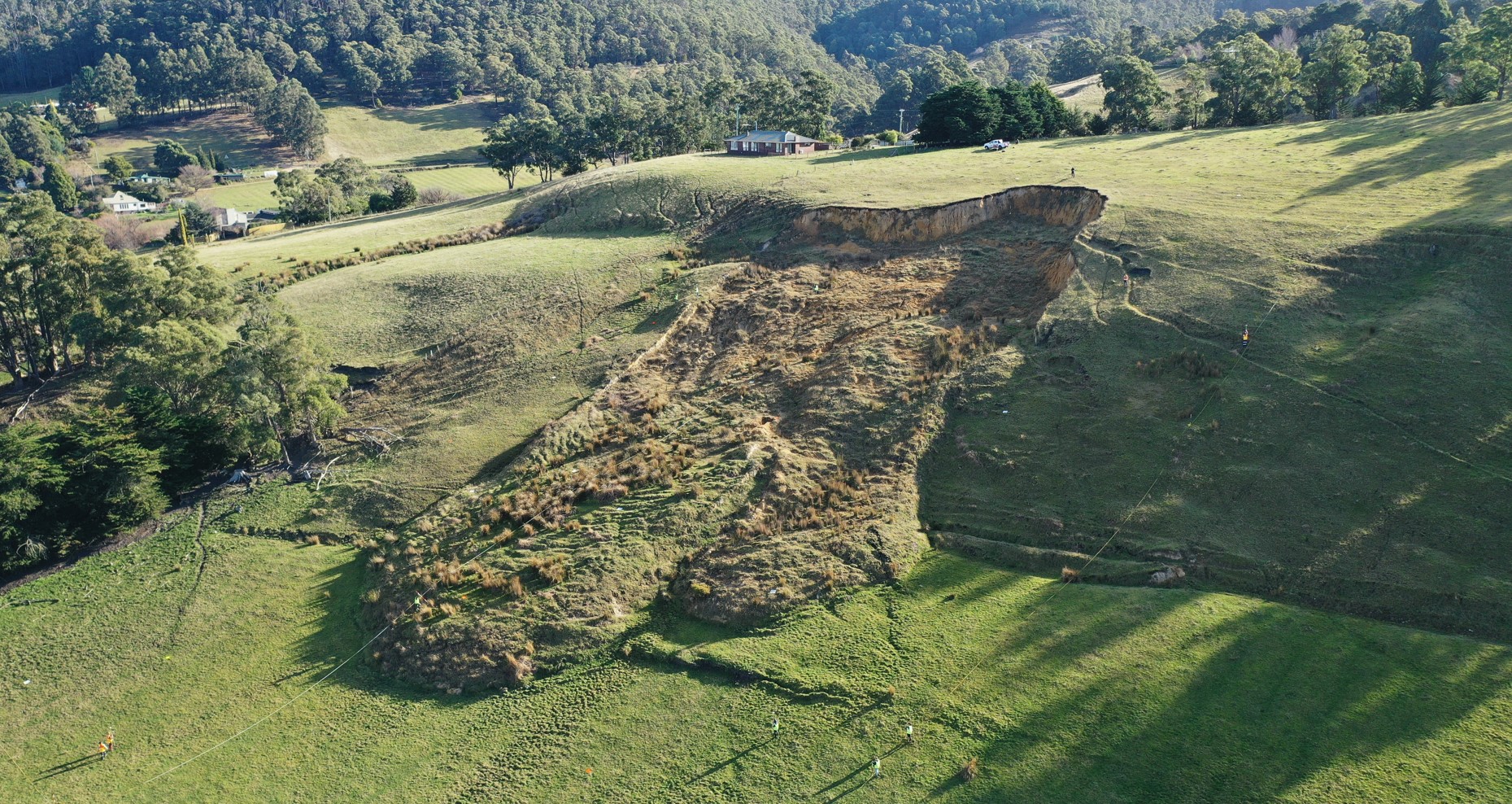
There was a sizable landslide on the slopes behind the winery, a giant chunk of the green hill had slipped, and a muddy, rocky face was left behind. It was brimming with possibility for this geography and spatial sciences researcher and teacher, who is now the Head of School of Geography, Planning and Spatial Sciences at the University of Tasmania.
Over the coming weeks, Professor Lucieer spoke to the owners of the winery about their landslide, and they agreed to let the lecturer bring his students out to site to investigate and learn about spatial data collection.
It was a win-win; the Home Hill owners would have a professional keeping an eye on the slope that was slowly slipping down the hill on their property, and students would have the chance to get their hands dirty with a real-world spatial sciences project.
Every year for 20 years now, Professor Lucieer has returned with his students and a team of geography and spatial science staff to put what they’ve learnt in the classroom into action.
“In 2004 a day out on the landslide looked a little different to how it looks now – the technology has come a long way in our discipline of science over that time,” Professor Lucieer said.
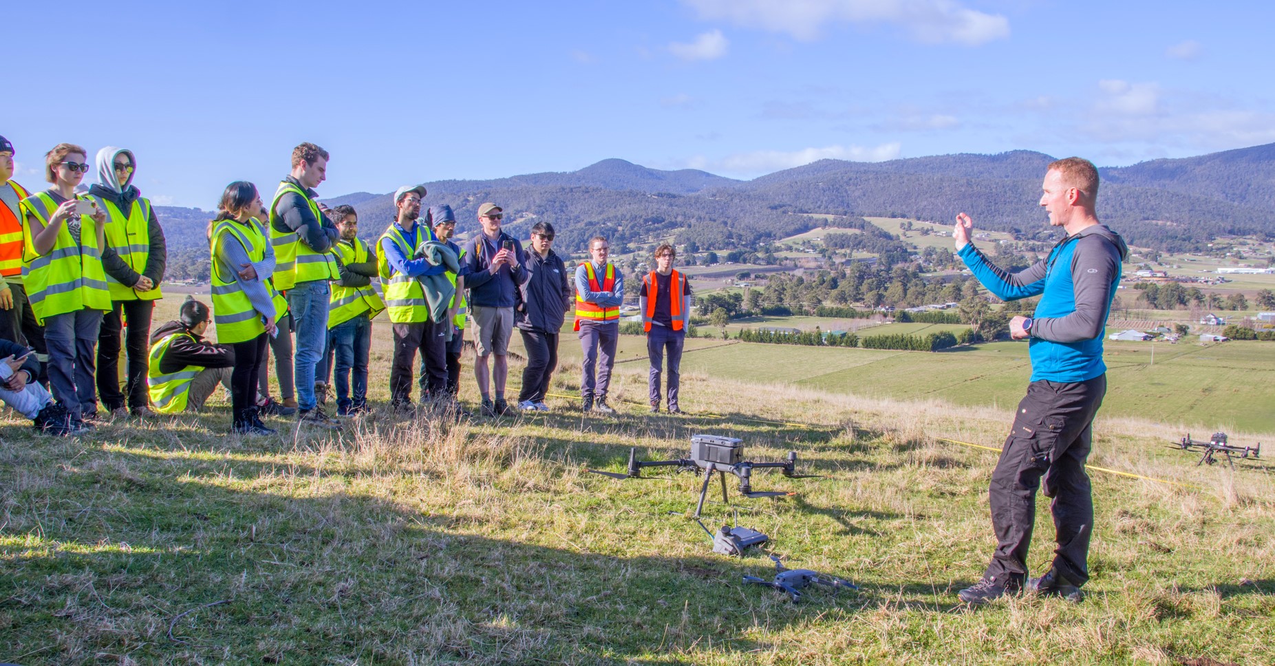
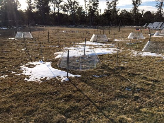
“Students use apps on their phones for part of their field work now, and this year we’re showing students how we can use highly advanced drone technology to map the landslide and all its features.
“What these technological advancements can mean for the accuracy of the data we collect over time is amazing.”
But some things don’t change.
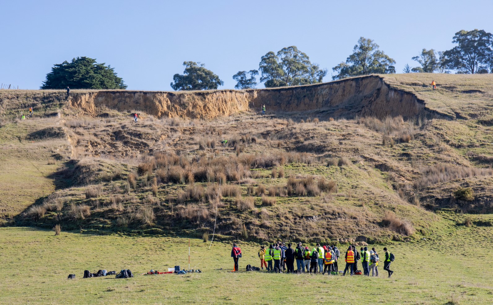
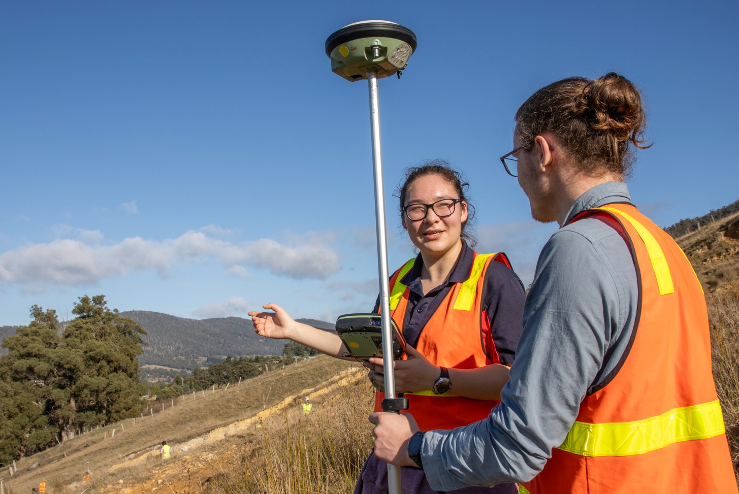
Students also learn the traditional methods of mapping the site – spending their days working in teams to walk across the entire area of the landslide – back and forth, up and down - measuring by hand the characteristics of the landslide and plotting coordinates that they’ll use to create 3D maps and study in depth back in the lab on campus.
It’s not easy work. The students are a bit muddy, a bit sweaty, they’re transecting uneven terrain and watching their step as they stick close but not too close to the edges of the landslide.
“Sending a drone up is safe, fast, sometimes more accurate, and very efficient, so it’s becoming a preferred method of mapping in industry so it’s great for students to see how it works for themselves.
“We’re teaching them how to use a range of surveying and mapping technologies that students can use for a wide variety of spatial applications –Global Navigation Satellite Systems (GNSS) are widely used by professionals for mapping tasks. Using mobile devices for mapping in the field is also increasingly common in a range of industries, so we want students to be able to step into any situation and know what to do and how to use the available tech,” Professor Lucieer said.
“They understand the science thoroughly and they have had the practice in the field to be able to tackle the challenges that come with our territory.
“And they usually love this part of the job – getting outdoors. You get fresh air, great views, time with colleagues and to enjoy the realities of the earth’s fascinating wonders.”
University of Tasmania staff Dr Steve Harwin and Mark Williams have also been heavily involved in making this rich, hands-on experience a success for students, dedicating hours to coordinating dozens of students to visit the site, over the years, and designing activities that supercharge their learning.
“Our staff are really the backbone of great activities like this – you only get out what you put in when it comes to creating outstanding student experiences, and we all put a lot in,” Professor Lucieer said.
Over the last 20 years, the landslide has moved up to metres each year, depending on the weather and activity in the area that year.
In total it has moved 30-50 metres down the hill since it first appeared in 1996, eight years before we started visiting.
“In general, we look at how fast it’s moving, which parts are moving and where it’s moving to, and all of this information helps us to understand whether it poses any risk to people or property surrounding it.
“This landslide poses no risk to its surrounds, but there are many other landslides all across Tasmania and Australia which might pose more of a risk to people and buildings.
“We’re lucky to have fantastic, longstanding community partners who help us to prepare our students to be skilful advisors on the dangers around landslides when they enter the workforce,” Professor Lucieer said.