
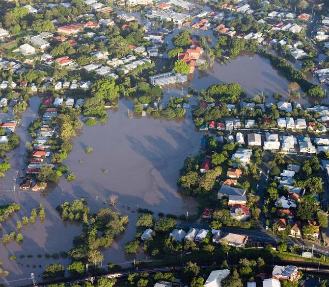
How will rising sea levels and storm surges affect our coastal buildings and roads? With more than half of Australians living within seven kilometres of the coast, we need to plan for the rise in sea levels predicted for coming decades.
The Canute sea-level calculator is a software model developed by University of Tasmania climatologist Dr John Hunter and Dr Steve George in partnership with the Antarctic Climate and Ecosystems Co-Operative Research Centre
Canute combines data from tide gauges and storm surge modelling with estimates of future sea-level rise, to predict the likelihood of future flooding from the sea.
The calculator allows planners to assess the height and position that infrastructure needs to be set back from the sea, to avoid flooding and erosion.
Calculations for hard shorelines will estimate elevation above sea level, while soft shorelines need an estimate of setback distance from the water to avoid recession.
Canute includes different calculations to let coastal planners consider a number of different factors that might affect the future positions of buildings and roads. These can include waves and tropical cyclones.
The software is named for the Viking King of England, King Canute, who in legend unsuccessfully demanded that the tide fall back on his command.
More than 550 local governments and engineering firms now use the Canute software to aid in coastal planning.
Over the last century, sea level rose about 16 cm with a global-average rate of 1.6 mm/year.
Sea water continues to expand as global temperatures rise with climate change, and polar meltwater is also contributing to an expected rise of between 20 and 80 cm in the coming century.
We will mostly experience sea-level rise through increased flooding events. By the time Australia has experienced sea-level rise of 50 cm, expected to occur within the next century, we will also experience an almost 300-fold increase in flooding events.
A 2011 Federal Government report estimated that commercial, industrial, road and rail, and residential assets around Australia’s coasts worth over A$226 billion will be potentially exposed to flooding and erosion hazards if seas rise by 1.1 m. Canute could mitigate these costs by ensuring better-informed coastal planning.
Also:
- Rio Tinto are using University of Tasmania-developed technology in their global hunt for new copper deposits. ‘Greenfields’ was developed by scientists at the University-based ARC Centre of Excellence for Ore Deposit and Earth Sciences (CODES).
- Around 80 per cent of the ocean floor in Australia’s marine territory has not yet been surveyed. The Seamap Australia project brings together all the available information from marine surveys about Australia’s seafloor habitats and depths to form a consistent continent-wide marine habitat mapping service. These maps will help make shipping safer, give insights into the impacts of coastal erosion and storm surges, reveal tsunami risks, show the distribution of marine habitats, and provide a registry of marine assets such as mineral resources and fisheries. The project sits under the Institute for Marine and Antarctic Studies at the University of Tasmania.
Interested in conducting your own research? Apply now to become a research student.
Interested in partnering with the University of Tasmania? Find out more here.