Welcome to the webpage of the 50th Anniversary of the UTAS Surveying and Spatial Sciences discipline.
This year we welcome current and former staff, alumni, current students and friends to join us in an exciting program of celebratory events. The 50th anniversary celebrations are an opportunity for our Alumni to reconnect with their university, their discipline, current students and each other. We are excited to catch up with you all at these events and via this webpage over the coming year.
The University is proud that our discipline holds a key role nationally in an industry that is among the nation’s fastest growing sectors. Many highly respected surveyors and spatial scientists nationally and around the globe have been educated here at the University of Tasmania.
Our teaching has always been well connected to the world class research conducted by academic staff, associates, postdoctoral researchers, and our research higher degree students. Together we continue to employ our disciplinary skills and knowledge to help address problems of great social and physical significance such as changing climates, rising sea levels, and biodiversity conservation.
We look forward to inspiring a new generation of surveyors and geospatial scientists, forging new connections, enhancing existing relationships and catching up with our alumni and friends during this 50th anniversary year.
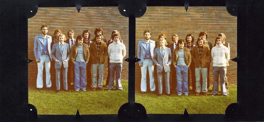
Image caption: John Dent et al. Stereo pair class.
50th Anniversary Events 2022
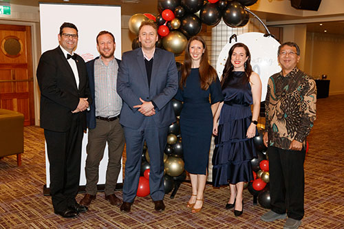
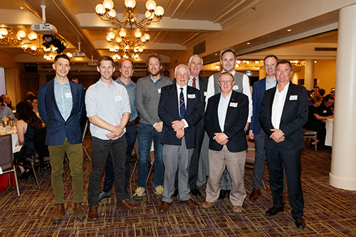
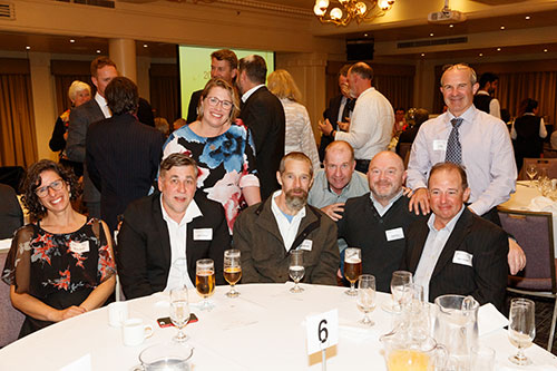
Thank you to those who joined us in celebrating 50 years of surveying and spatial sciences in Tasmania at the Launch, Gala Dinner and Reunion BBQ this year. Each event provided a great opportunity to catch up with our colleagues, students, alumni & friends face to face to mark this important milestone year.
An album of official photos from the Gala Dinner are available on the UTAS Alumni Facebook page.
Surveying and Spatial Sciences Alumni Ambassadors
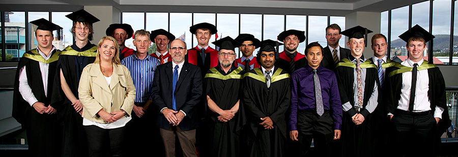
Image caption: Recent graduates of Spatial Science, University of Tasmania.
To celebrate 50 years of Surveying and Spatial Sciences in Tasmania, a group of our valued University of Tasmania surveying and spatial sciences alumni will be sharing throughout the year their favourite memories, stories and reflections on their time studying, and their career journey within the sector to date.
Dr Elyse Allender
Assistant Director at Australian Space Agency
Bachelor of Geomatics and Bachelor of Surveying and Spatial Sciences (Hons), University of Tasmania
Linked in profile
Dr Elyse Allender is a researcher and planetary scientist. She holds both a Bachelor of Geomatics and a Bachelor of Surveying and Spatial Sciences with Honours from University of Tasmania. She completed PhD in the USA at the University of Cincinnati in 2016.
Her research focused on the development of an automated processing pipeline for analysis of Martian orbital imagery. Using data mining techniques she was able to detect the locations of distinct minerals on the surface of Mars which may be of interest for future exploration activities.
Elyse is currently Assistant Director within the Space Technology Uplift team in the Office of the Chief Technical Officer at the Australian Space Agency.

Nicholas Davies
Client Director- Digital and Spatial at Veris
Bachelor of Geomatics (Hons), University of Tasmania
Linked in profile
Nicholas Davies is an experienced board director in both the NFP and commercial sectors as well as being a strong technical professional in 3D laser scanning (digital & spatial). He holds a bachelor’s degree in Geomatics with Honours from the University of Tasmania and an Executive MBA from Melbourne Business School.

Paul Digney
Survey Technical Director at Jacobs Australia
President at Surveying & Spatial Sciences Institute (SSSI)
Bachelor of Surveying (Hons), University of Tasmania
Linked in profile
Paul Digney is the Survey Technical Director for Jacobs Australia and is a licensed surveyor in Tasmania and Victoria with over 25 years’ experience in the surveying/spatial profession.
Paul has shared his employment equally between public and private sector roles with a strong focus on geodetic/cadastral surveying and more recently 3D laser scanning, digital engineering and strategic consulting.
Paul holds a Bachelor of Surveying with Honours from the University of Tasmania and a Graduate Certificate in Management University of Western Sydney.
Paul is an enthusiastic Tasmanian who is a current Director and President-Elect of the Surveying and Spatial Sciences Institute (SSSI) and has been actively involved with the SSSI and legacy organisations over the past two decades.

Alexander Leith
Deputy Director of the Australian Ocean Data Network at IMOS
Bachelor of Surveying and Spatial Sciences (Hons), University of Tasmania
Linked in profile
Alex holds a Bachelor of Surveying and Spatial Sciences with Honours from University of Tasmania. Using his honours research he was able to get his first job out of university, with Lester Franks. Since then he has worked as both a consultant and for Glenorchy City Council, TasNetworks, FrontierSI and GeoScience Australia.
With experience in software development, deployment, configuration, maintenance, training and support, Alex recently commenced a role as Deputy Director of the Australian Ocean Data Network for Integrated Marine Observing System (IMOS).

Dr Anna Riddell
Assistant Director, Australian Geospatial Reference System at Geoscience Australia
Bachelor of Surveying and Spatial Sciences (Hons) and PhD, University of Tasmania
Linked in profile
An interest in science and the changing size and shape of the Earth piqued Anna’s curiosity and led her to study a Bachelor of Surveying and Spatial Sciences (Hons) at University of Tasmania. She was successful in gaining a graduate placement at Geoscience Australia (GA) and her while her career has spanned many roles over the years, she remains at GA today.
At GA she has worked on many notable projects including construction and installation of stations in the AuScope GNSS network; operation of the robotic GNSS antenna calibration facility; liaising with state and national counterparts for the technical implementation of the new national datum (GDA2020) and working with international colleagues for the adoption of a United Nations resolution on the importance of a global geodetic reference frame.
Anna's PhD is in the field of Geodesy where she researched the vertical land motion of the Australian crustal plate using the AuScope GNSS network.

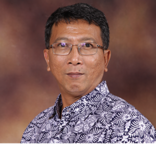
Dr Antonius Wijanarto
Deputy Chairman for Thematic Geospatial Information at Geospatial Information Agency of Indonesia
Bachelor of Surveying (Hons) and PhD, University of Tasmania
Linked in profile
Antonius holds a Bachelor of Surveying with Honours and a PhD from University of Tasmania. He moved to Tasmania to undertake both undergraduate and then postgraduate study, before returning to his home country of Indonesia.
Throughout his career Antonius participated in establishing the Geospatial Information Act in Indonesia as well as heading up the Centre for Data Management and the Centre for Geodetics Network and Geo-dynamics. During this time he helped to establish 200 CORS stations and 100 tidal stations, used as part of the Indonesian Tsunami Early Warning System. In mid-2019 he became Deputy Chairman for the Indonesian Geospatial Information Agency.